- Biology Department
- Pre-Health Advisory Committee
- GIS Center
- Medical Laboratory Science
- Museum of the Earth Sciences
- Mathematics and Statistics
- REALISE
- Chemistry Department
- Radford University Planetarium
- Department of Physics
- Anthropological Sciences
- Geology
- Selu Observatory
- Center for Information Security
- Forensic Science Institute
- Biomedical Science
- Geospatial Science
- School of Computing and Information Sciences
- MS in Data And Information Management
About the Geospatial Science Program
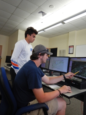
Geospatial Science is a discipline that focuses on using information technology to understand people, places, and processes of the earth. Spatial analysis of human and physically variables is fundamental to the discipline. Remote Sensing, Geographic Information Systems (GIS), and Global Positioning Systems (GPS) technologies are commonly used as measurement, observation and analysis tools. The discipline is a science foremost because the scientific method is used to answer questions and draw conclusions, but also because the discipline acts as a bridge between the human and physical sciences. Studying geospatial science prepares majors for a wide variety of career opportunities in business, government, and education. Career opportunities for geospatial science majors continue to grow as the field becomes more widely recognized by people outside the discipline.
What makes Geospatial Science different?
What differentiates the discipline from other sciences is that the conclusions include a spatial component. This makes for stronger conclusions and a better understanding of the world, thus allowing decision makers from multiple disciplines to be better informed. The applications of Geospatial Science range from natural and social sciences, to marketing and communications. The U.S. Department of Labor predicted that geospatial jobs would be one of the three fasted growing sectors in the coming decades, giving graduates in Geospatial Science tremendous and diverse opportunities.
Tell me more about Geospatial Science

Your Future in Geospatial Science
The U.S. Department of Labor has recently identified geospatial analysis as one of the leading areas of employment in the coming decades. Graduates of Radford University’s Geospatial Science Department often are quickly employed in government positions and at private business, or they attend graduate school.
Where do Radford University geospatial science graduates work today?
- GIS Analyst --- IHS Market
- Geospatial Web Developer --- ICF International
- GIS Analyst --- World View Solutions
- Cartographer --- Norfolk Southern Railroad
- GIS Coordinator --- Pulaski County, VA
- GIS Technician --- NASA Develop
- Google Map Field Operations Specialist --- Google
- Geographer --- Dewberry
Interested in learning more about the applications of Geospatial Science? Watch the Geospatial Revolution videos.

Geospatial Revolution videos - Episodes 1 - 4
------------------------------
Jack Dangermond of ESRI on how a geospatial nervous system could help us design a better future
