
Appalachian Plateaus Physiography: Scenic Tour, Part 2
Cumberland Gap
• Cumberland Gap is located at the intersection of Kentucky, Tennessee, and Virginia in Lee County. At the southwest tip of Virginia, the Virginia-Kentucky state line follows the Valley and Ridge - Appalachian Plateaus province boundary. Cumberland Gap National Historical Park is located here.
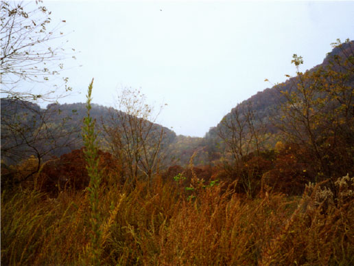
Cumberland Gap, seen from the east side in Lee County, Virginia. This gap is the only natural break in the Allegheny Front, the eastern edge of the Appalachian Plateaus, for hundreds of miles. Thousands of visitors come here each year to enjoy the scenic and historic resources. (Photograph by Phyllis Newbill)
• Cumberland Gap is a 600-foot-deep wind gap cut through the steep escarpment that forms the eastern edge of the Plateaus province. The rocks exposed here are Mississippian sandstones and limestones and Pennsylvanian sandstones.
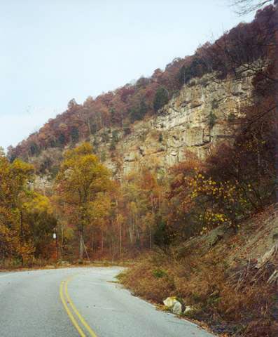 This photograph shows some of the Paleozoic sedimentary rocks exposed along the old road through Cumberland Gap. Ordovician layers are found near the bottom of the gap, and younger (Silurian, Devonian, Mississippian, and Pennsylvanian) rocks occur as one travels up the mountain. (Photograph by Phyllis Newbill)
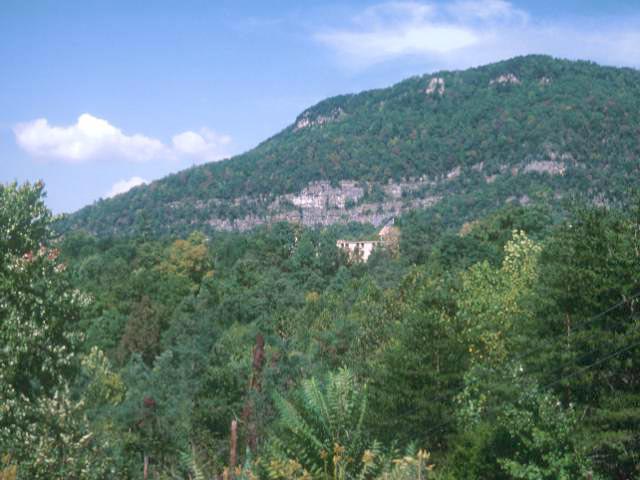
Cumberland Gap was extremely important during the early history of the United States. It was the only natural gateway through the 1000-foot-high Allegheny Front, and settlers headed west for the frontier lands of Kentucky came through this gap. (Photograph by Robert Whisonant)