Scenic Tour of the Valley and Ridge (Part 1)
• Some of the most beautiful landforms in Virginia are formed on the rocks of the Valley and Ridge. The six special scenic areas shown below are chosen for both the natural beauty and the interesting geology found at these localities.
• Click on the locality names for more information
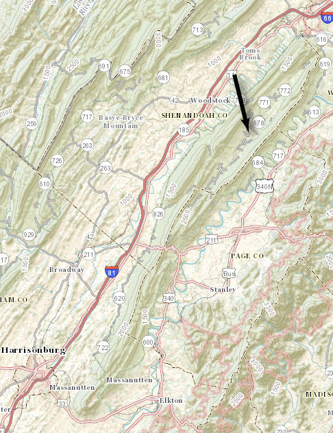
Location Map of Scenic Tour
Location map for the scenic tour of the Valley and Ridge. Click on the location names for photos and information. (Base map couresy of the Virginia Divison of Geology and Mineral Resources)
Massanutten Mountain
• Massanutten Mountain is located in the northern Shenandoah Valley. It rises about 1500 feet above the level of the valley and is about 50 miles long.
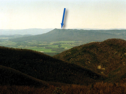
Massanutten Mountain (arrow), in the northern Shenandoah Valley, can be seen from miles away on the Blue Ridge Parkway and on Interstate 81. (Photograph by Stan Johnson)
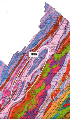 Geologic map of Massanutten Mountain area (oval). Note Devonian shales (Dma) present in the northern part of the mountain. (Map courtesy the Virginia Division of Geology and Mineral Resources)
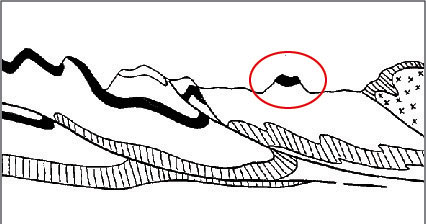
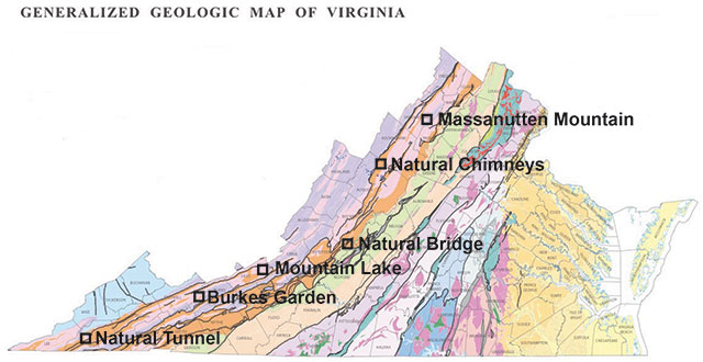
Massanutten Mountain is an example of inverted topography. The mountain has formed on a syncline, as shown circled in the cross-section above. A lowland has formed in the center of the syncline, as shown below. (Above: Image from the Virginia Division of Geology and Mineral Resources. Below: from the National Map, United States Geological Survey)