
Scenic Tour of the Valley and Ridge (Part 5)
Burkes Garden
• Burkes Garden is located in the Valley and Ridge province in southeastern Tazewell County. It is a large oval-shaped basin ringed by high mountains on all sides.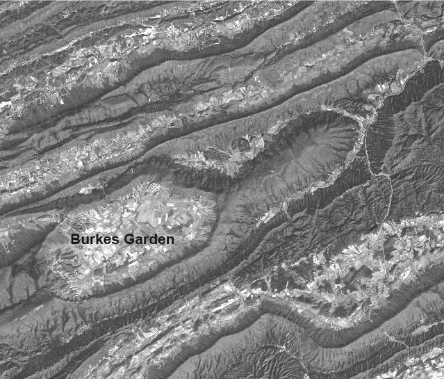
Burkes Garden is one of the most spectacular topographic features in Virginia. This image, taken from space, shows its elongated basin form with mountains surrounding the valley on all sides. (Photograph courtesy of American Electric Power)
• Burkes Garden is a breached sandstone dome, meaning that erosion has cut through the harder Silurian sandstones on top of the dome. Softer Ordovician shales and limestones in the center of the dome form the low valley floor. Hard Silurian sandstones form the ridges around the edge.
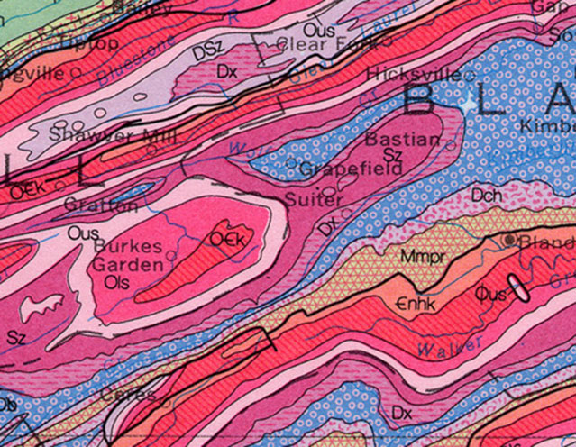 Geologic map of Burkes Garden. Burkes Garden formed on domed Silurian and Ordovician sedimentary rocks. Erosion wore through the center of the dome, exposing the softer rock below to the weather. The softer rock formed a valley, while the edges of the dome formed ridges. Burkes Garden is a classic example of inverted topography. In this map, the Sz is the sandstone that forms the doughnut-shaped ridge, and the OCk, Ols, and Ous are the softer carbonates and shale that forms the floor of the "garden". (Map courtesy of the Virginia Division of Geology and Mineral Resources)
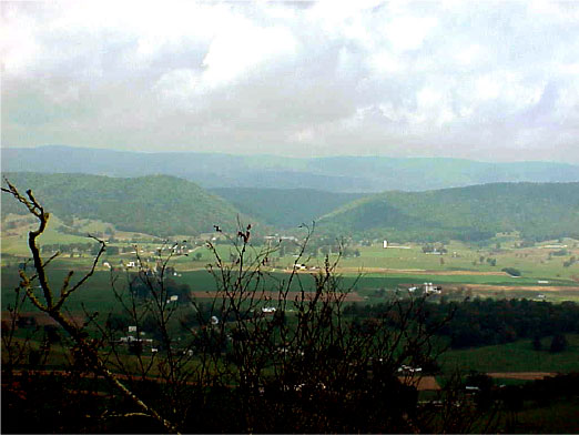
View across Burkes Garden looking at the water gap cut through the ridge on the west side of the valley. According to one story, Burkes Garden is named for John Burke, who left potatoes at a camp site that later sprouted, forming a “garden.” (Photograph by Bill Anderson)