|
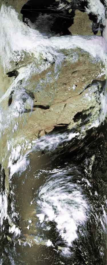
Satellite: NOAA-16
July 29, 2004; flyover beginning 2:40pm EDT
This picture shows a non-threatening storm as it was heading towards the
southeastern coast; the reason this storm was not considered threatening is
explained in the Satellite Image of the Day for
July 29, 2004.
Note in this image how far the storm is from the coast. You can see the
trailing clouds showing the direction in which the storm is moving. This
initial northwest motion is typical of Atlantic tropical depressions.
|
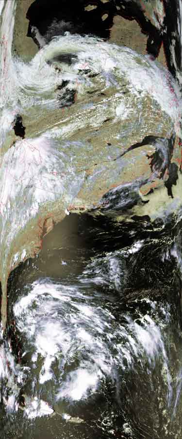
Satellite: NOAA-16
July 30, 2004; flyover beginning 2:29pm EDT
The picture below was taken in the afternoon ~24 hours after the picture at
the left.
Note how the storm has moved closer to our coast, has dissipated, and will
bring only clouds and rain to the southeast when it makes landfall.
This storm, however weak, shows the typical type path that Atlantic
hurricanes may follow: They start out heading to the northwest, turn to the
north, and then return to sea by turning to the northeast.
When these storms and hurricanes make their turns determines whether they
build in intensity (by staying above warm, heat-energy-losing water) or lose
intensity, and whether or not they reach our shores.
Stay tuned for more images as hurricane season comes upon us. |