
Coastal Plain, General Physiography, Part 1
The general physiography of Virginia’s Coastal Plain includes discussions of:
3. Drainage
Width and Boundaries
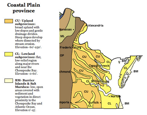
• The Coastal Plain occupies the eastern quarter of the state (about 10,000 square miles).
The Coastal Plain occupies the eastern quarter of the state. [Image from College of William & Mary geology website, courtesy of C. M. Bailey]
• It is known as the Tidewater because rivers are strongly influenced by tides near the river mouths and far upstream.
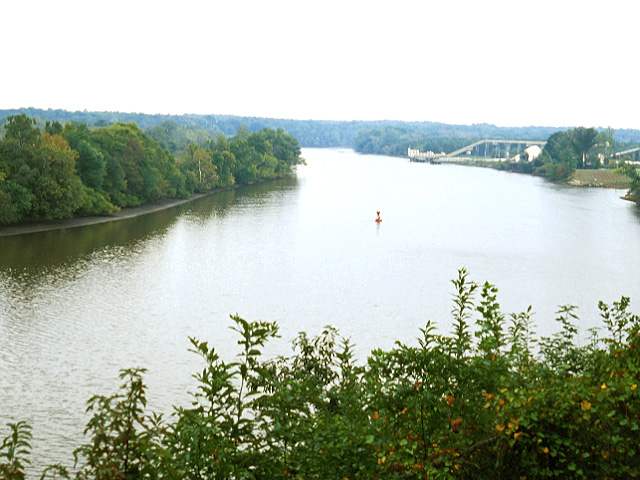
Drewry’s Bluff on the James River. Note sediments exposed by low tide along left bank. This location is about 20 miles south of Richmond and about 100 miles from the coast. (Photograph by Robert Whisonant)
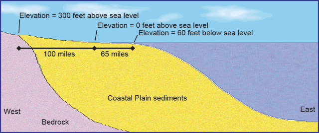
To determine the gradient across an area, divide the change in elevation by the horizontal distance across the area. For example, 600 feet divided by 65 miles equals a gradient of 9.2 feet per mile for the underwater part of this cross section.