|
|
||||||||||||||||||||||||
|
||||||||||||||||||||||||
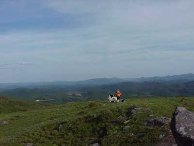 Left: view to the southeast. Left: view to the southeast. |
||||||||||||||||||||||||
| There is probably not a desire to rush away from this spectacular view, but if you are up to it, continue along the AT to the southwest. The trail will drop quickly and suddenly the rhyolite will be replaced by light colored outcrops. | ||||||||||||||||||||||||
|
|
||||||||||||||||||||||||
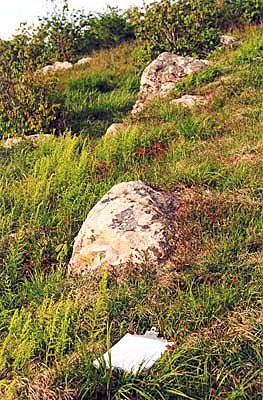 |
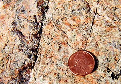 We have obviously crossed out of the rhyolite and into something different, yet familiar. What type of rock is this? (Hint: look closely at the texture. Is it coarse or fine? What is the color of the rock? Can you see what minerals are in here?) We have seen this rock before on this trip. Where have we seen it? See the answer page for lots of additional information! We have obviously crossed out of the rhyolite and into something different, yet familiar. What type of rock is this? (Hint: look closely at the texture. Is it coarse or fine? What is the color of the rock? Can you see what minerals are in here?) We have seen this rock before on this trip. Where have we seen it? See the answer page for lots of additional information!
If you backtrack up the trail toward Buzzard Rock, see if you can find the approximate boundary between this rock and the Buzzard Rock rhyolite. Just above the contact, note the pieces of the rhyolite. They are distinctly rubbly and contain clasts of different material. What might have caused this? |
|||||||||||||||||||||||
|
This is the last stop of the field trip. For a big picture summary of the geologic history of the Mount Rogers area, see the Geologic History page.
|
||||||||||||||||||||||||
|
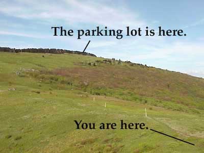
Now it is time to huff and puff your way back to the vehicles. You can see in the picture below exactly where you are now, and where you need to be in order to drive home. Don't be discouraged, though; you CAN do it.
|
||||||||||||||||||||||||
|
||||||||||||||||||||||||
