
Appalachian Plateaus Physiography: Drainage
• The Appalachian Plateaus is drained by the Tennessee and tributaries of the Big Sandy River in West Virginia.
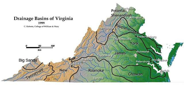
Map of Virginia's major drainage basins. Note that the Tennessee and Big Sandy systems are part of the Guf of Mexico drainage area. (Image from College of William & Mary geology website, courtesy of C.M. Bailey)
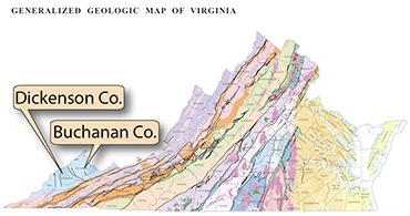 Dendritic drainage patterns are present in the Appalachian Plateaus in Buchanan, Dickenson, and Wise Counties. Notice how the major streams flow northwest, indicating that the general slope of the province is in that direction.
The province boundary with the Valley and Ridge is seen on the southeast corner of the map near Richlands. The map shows primarily Buchanan and Dickenson Counties, and parts of Russell, and Tazewell Counties, and the states of Kentucky and West Virginia. (Map data: Google)
Dendritic drainage patterns are present in the Appalachian Plateaus in Buchanan, Dickenson, and Wise Counties. Notice how the major streams flow northwest, indicating that the general slope of the province is in that direction.
The province boundary with the Valley and Ridge is seen on the southeast corner of the map near Richlands. The map shows primarily Buchanan and Dickenson Counties, and parts of Russell, and Tazewell Counties, and the states of Kentucky and West Virginia. (Map data: Google)