|
|
|
|
|
|
|
|
|
|
![]()
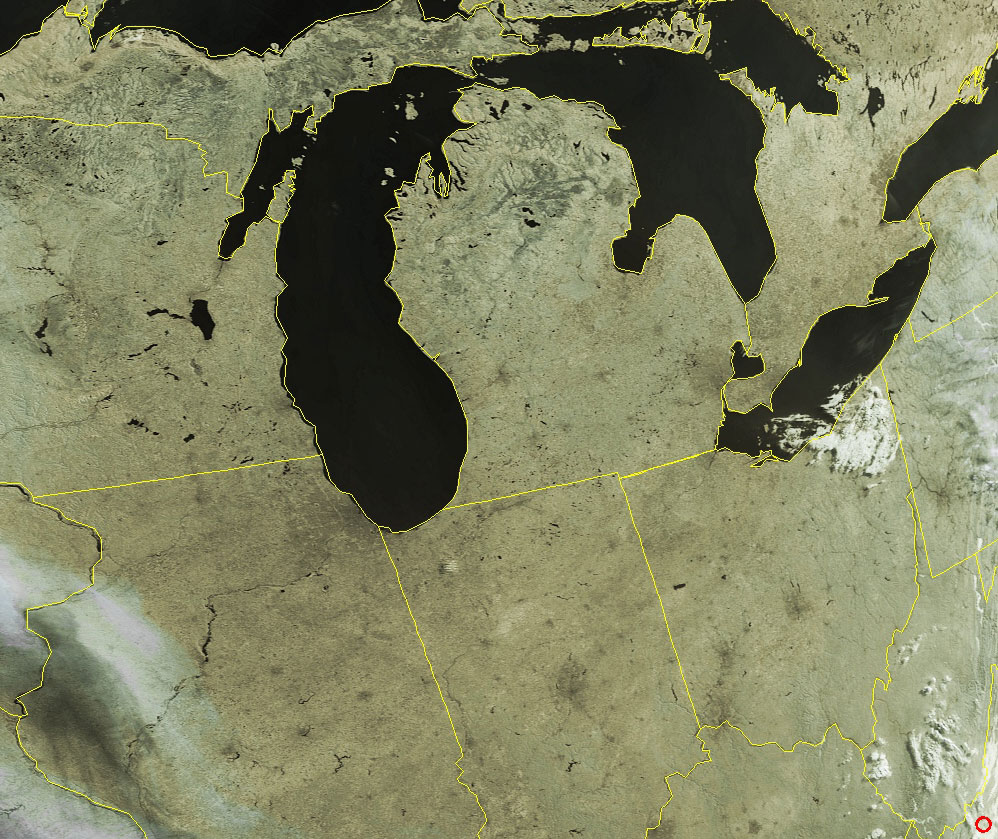
Satellites: NOAA-15, NOAA 16, NOAA 17 and NOAA-18, part of NOAA's 850km-high (530 mile-high) Polar Orbiting satellites
Signs of Life
The darkened areas in these images are major cities in the midwest:
Chicago on the southeastern shore of Lake Michigan;
Detroit across the Michigan peninsula;
The cites dotting southern Michigan;
Toledo at the western tip of Lake Erie;
Indianapolis, Dayton, and Columbus all in a line;
Cincinnati near where Ohio meets Kentucky and Indiana;
and even the buildup along I-90 heading east from the Chicago area to Toledo.Click on the image for a high-resolution version (~260k).