|
|
|
|
|
|
|
|
|
|
![]()
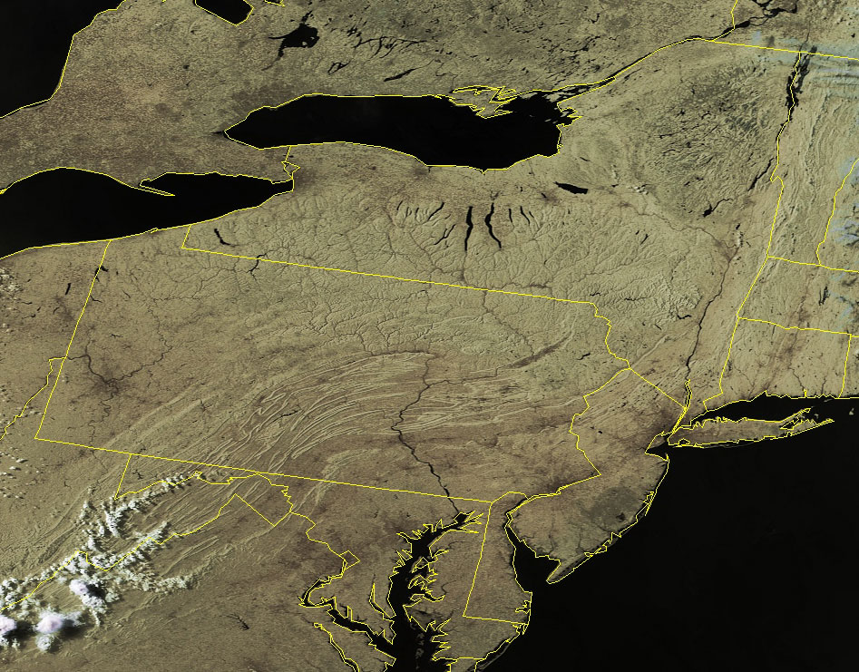
Satellites: NOAA-15, NOAA 16, NOAA 17 and NOAA-18, part of NOAA's 850km-high (530 mile-high) Polar Orbiting satellites
Stark relief
The topography in the northeast really stands out in the early evening sunlight on this clear day.
The folds of the Appalachian Mountains undulate through Pennsylvania and into New York.
The scars left by retreating glaciers thousands of years ago are seen as the long lakes in New York.
Note also the darker areas of the city sprawl in the DC and Baltimore areas.
This sprawl may be seen to continue towards Philadelphia and New York City.
In the western part of Pennsylvania Pittsburgh stands out sharply.Click in the image below for a higher-resolution version (~250k).