|
|
|
|
|
|
|
|
|
|
![]()
Satellites: NOAA-15, NOAA 16, NOAA 17 and NOAA-18, part of NOAA's 850km-high (530 mile-high) Polar Orbiting satellites
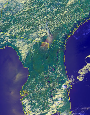
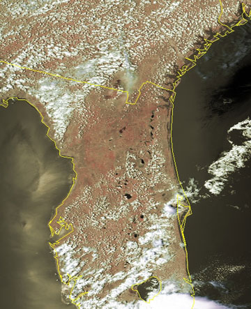
Where there's smoke...
These two images show the smoke crossing the Florida-Georgia border from the numerous fires in that area.
The image to the left is a simple RGB ("red-green-blue") image that is useful for delineating structure in clouds, etc.
The large smoky plume is distinguished from typical clouds by its brownish tint.
The image at the right is a more "processed" image that takes those colors (red, green and blue) and combines them in a way that reproduces (as much as possible) what our eyes would see if we were in space ourselves.
 |
 |

