|
|
|
|
|
|
|
|
![]()
Satellites: NOAA-15, NOAA 16, NOAA 17 and NOAA-18, part of NOAA's 850km-high (530 mile-high) Polar Orbiting satellites
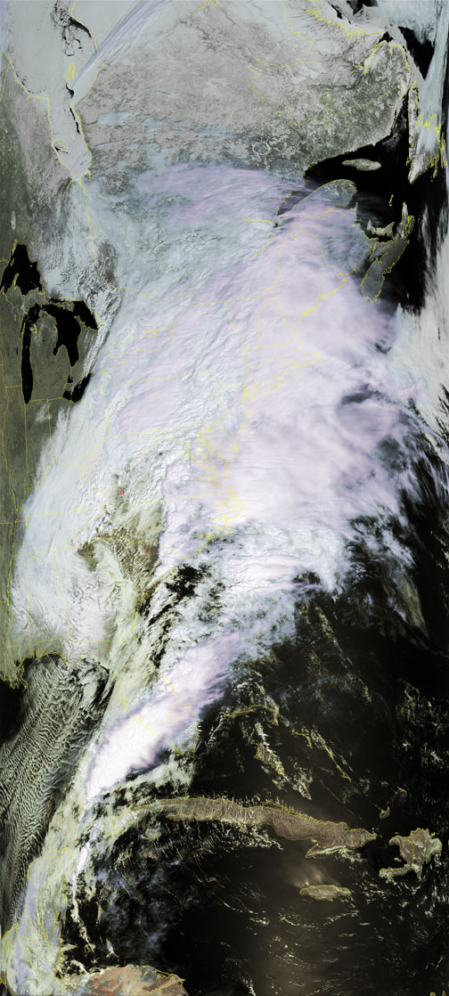
The 1000-mile storm
The image below shows the storm front that developed all along the eastern coast.
Cold air from Canada pushed downward, meeting warm and wet air pushing up along the eastern coast.
Where the two met, there resulted a mammoth storm front that left the northeast snowed in, and parts south flooded out.
You can see the spot in northwest Georgia where the two air masses were first colliding, resulting in an almost "eye of the storm" effect.
