|
|
|
|
|
|
|
|
|
|
![]()
Satellites: NOAA-15, NOAA 16, NOAA 17 and NOAA-18, part of NOAA's 850km-high (530 mile-high) Polar Orbiting satellites
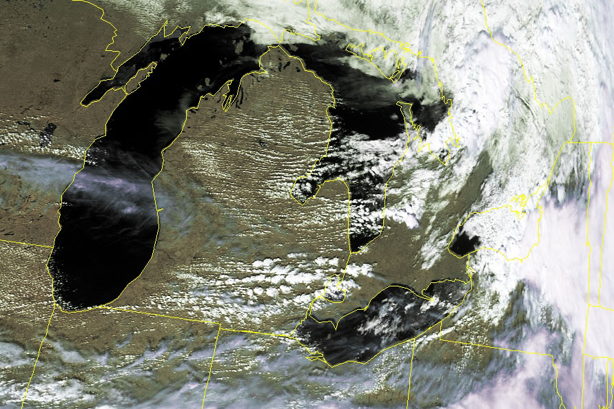
Classic example of the "lake effect"
The image below shows the lower Michigan peninsula and a class example of the
"lake effect."
The lake effect is occurring here because somewhat-dryer air is being blown
eastward off of Lake Michigan.
This cooler, dryer air passes over the land where it picks up moisture.
The warmer land this air passes over warms the air and causes it to rise.
But as the air rises, it is forced to cool.
As the air cools, it loses its capacity to hold onto the water in its invisible,
vapor form.
The moisture condenses out of this now-cooling air and we see the forming clouds
that result.
Click on the image below for a high-resolution picture (~200k).