|
|
|
|
|
|
|
|
|
|
![]()
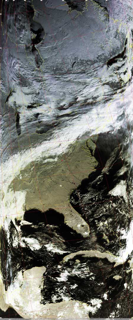
Satellites: NOAA-15 and NOAA-17, part of NOAA's 850km-high (530 mile-high) Polar Orbiting satellites
Wherez winter??
The two images below show how winter is just not happenin' now, at least for the
east and south.
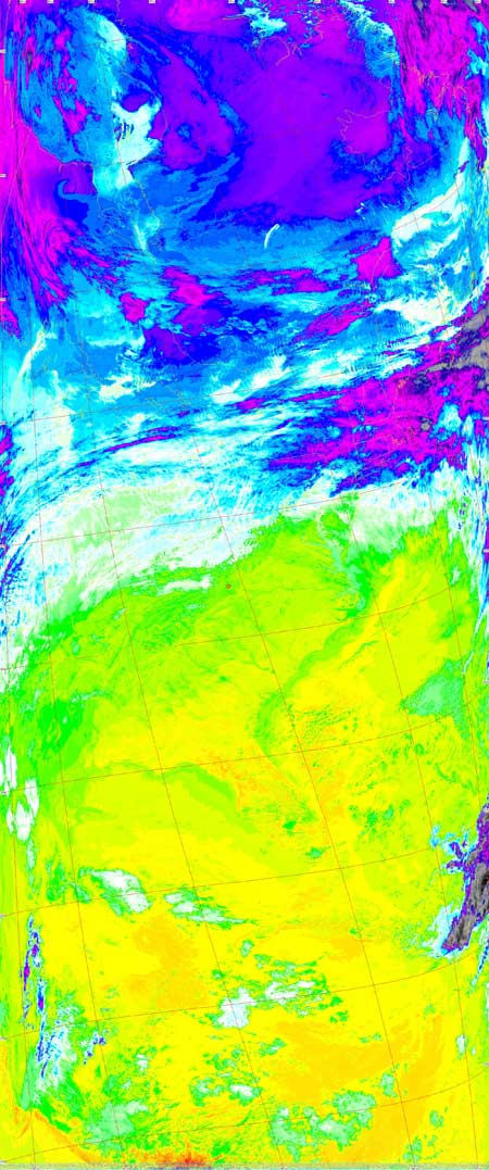
The false color image to the left could easily have been taken in the summer
months.
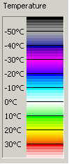
The temperatures seen in the image to the right are very high for time time of
year.
If one didn't know better, one might mistake this for the beginnings of a
summertime storm making its way up from the Gulf of Mexico due to a mid-latitude
system.
There is a counter-clockwise low pressure north of that line of clouds cutting
across the US midsection, and there is a big, stationary high pressure system
south of that cloud line, parked just off the southeastern coast of the US.
However, there are a couple of clues you can use to tell these images were obtained in or around December:
(1) The images were taken around midday, and the sun's rays are at a very low
angle, especially in northern Canada (long arctic night).
This is due to the curvature and the tilt of Earth's axis.
(2) There's snow covering much of the ground around, and east of Hudson Bay in
Canada.
 |
  |

