|
|
|
|
|
|
|
|
![]()
![]()
Satellites: NOAA-15 and NOAA-17, part of NOAA's 850km-high (530 mile-high) Polar Orbiting satellites
Last year, we had more hurricanes than the experts had
initially predicted.
This year, the experts had predicted that is was possible that
this could be a relatively busy hurricane season. (Note the
conditional words in this.)
Well, it has turned out to be a mild season so far, with the
rest of the season now being predicted to end up mild.
The reason for this is two-fold, with one of the reasons illustrated below.
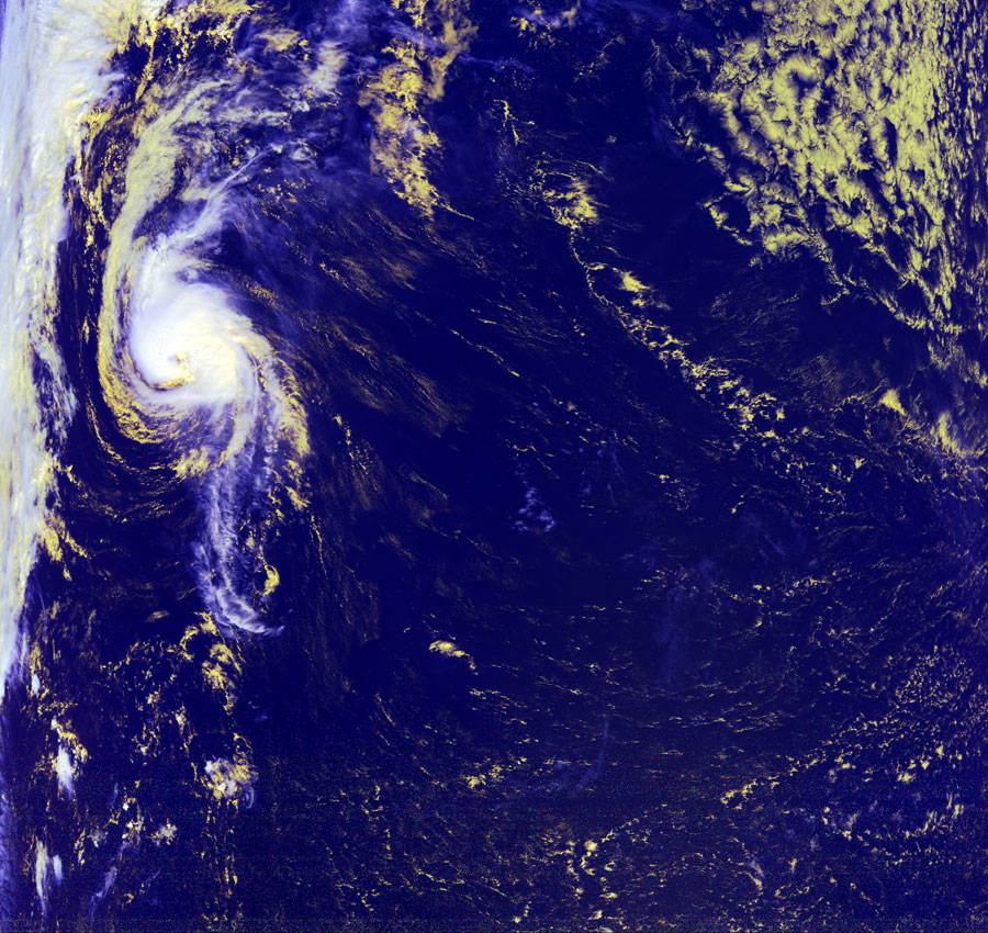
First, there is a stationary weather pattern over the continental US that's being held in place by a southward-dipping jet stream. This traps high-pressure systems right over the middle of the US, which keeps potential hurricane systems from coming ashore. The storm system below is a typical example. Note how far out into the Atlantic Ocean it is. The land that you see in the northwest of this image is Nova Scotia, located northeast of Maine.
Second, El Nino has recurred in the eastern Pacific Ocean, just to the west of the US. This is a heat-altering ocean current pattern whose bottom line for US hurricanes is to keep them from pulling much energy from the waters in the Atlantic Ocean (and Gulf of Mexico).
Click on the images below for a larger (~200k) image.
| Believe it or not, there have been at least some hurricanes this year. However, they have generally not made landfall in the US. Many of them, like this one pictured here (actually Tropical Storm Isaac, for those of you keeping track!) are pushed into the eastern Atlantic due to a large high-pressure system (and El Nino) over the middle of the US. | |
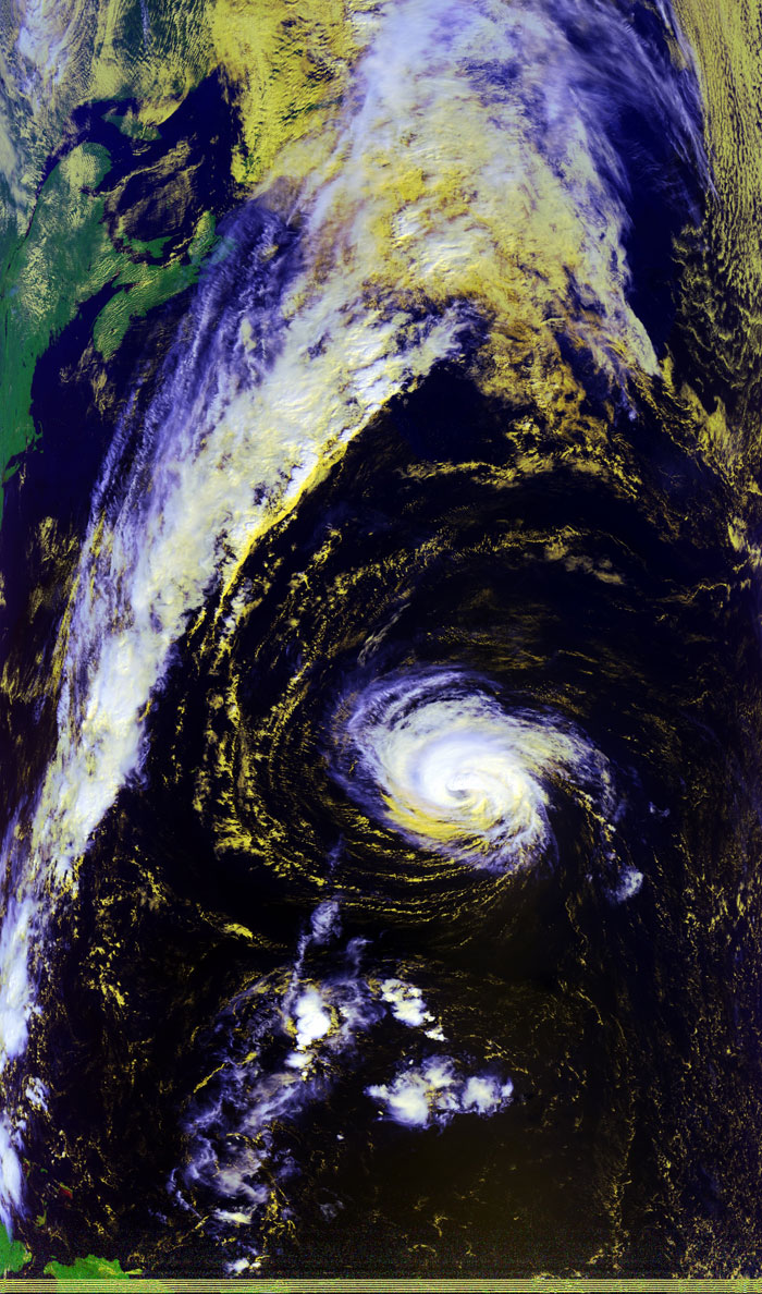 |
The picture to the left shows Isaac on Saturday, September 30, while the picture below shows Isaac on Sunday, October 1. Note how far out to sea Isaac is located. In the left picture below, you can see the tip of Maine as well as Newfoundland, with Isaac spinning relatively harmlessly out to sea. And yes, you can just abut see an "eye" but, since this is still a tropical storm, it's not a complete eye!
|