|
|
|
|
|
|
|
|
![]()
![]()
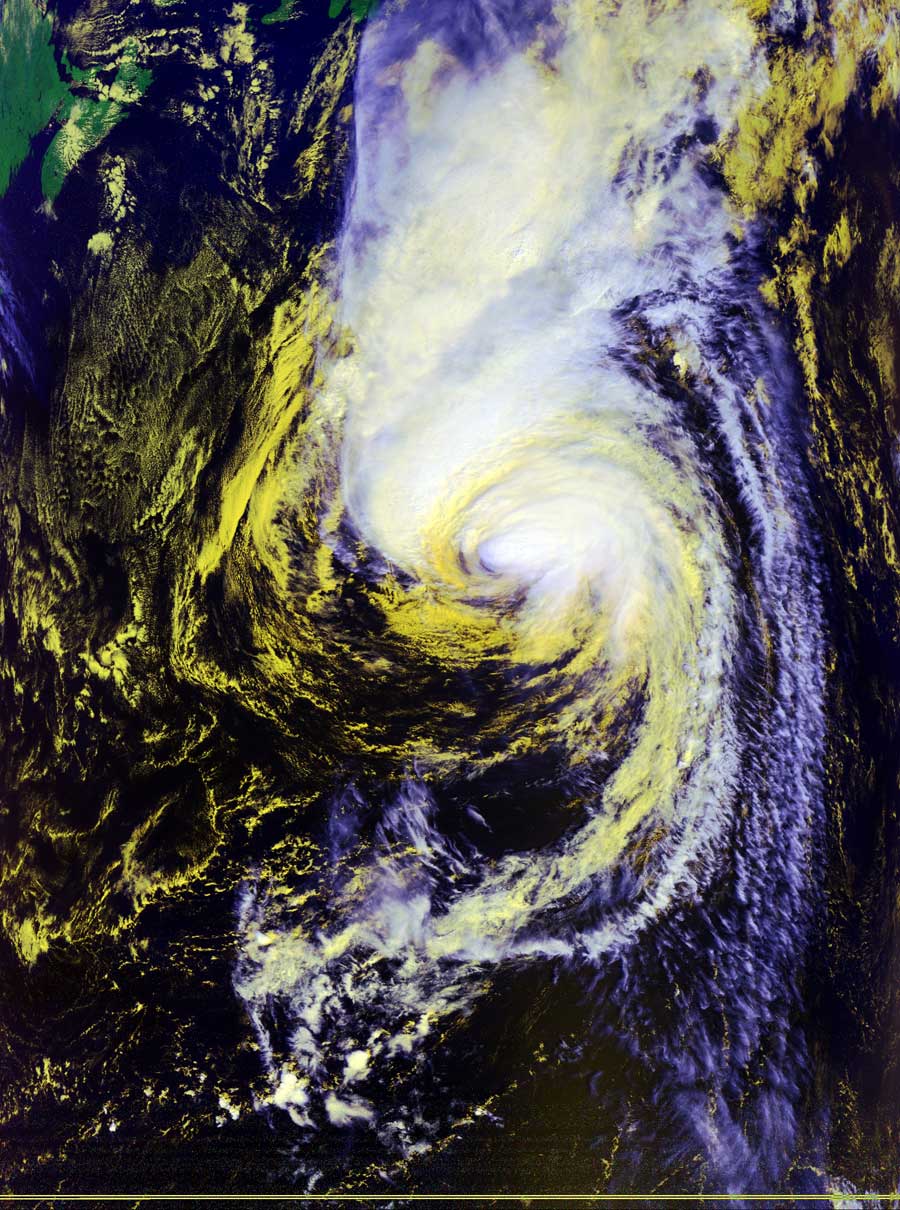
Satellites: NOAA-15 and NOAA-17, part of NOAA's 850km-high (530 mile-high) Polar Orbiting satellites
Last year, we had more hurricanes than the experts had
initially predicted.
This year, the experts had predicted that is was possible that
this could be a relatively busy hurricane season. (Note the
conditional words in this.)
Well, it has turned out to be a mild season so far, with the
rest of the season now being predicted to end up mild.
The reason for this is two-fold, with one of the reasons illustrated below.
First, there is a stationary weather pattern over the continental US that's being held in place by a southward-dipping jet stream. This traps high-pressure systems right over the middle of the US, which keeps potential hurricane systems from coming ashore. The storm system below is a typical example. Note how far out into the Atlantic Ocean it is. The land that you see in the northwest of this image is Nova Scotia, located northeast of Maine.
Second, El Nino has recurred in the eastern Pacific Ocean, just to the west of the US. This is a heat-altering ocean current pattern whose bottom line for US hurricanes is to keep them from pulling much energy from the waters in the Atlantic Ocean (and Gulf of Mexico).
Hurricane season is not over for at least another two months,
however, but we can take heart that it's been mild--and relatively safe for
people--so far.
Stay tuned...
Click on the image below for a larger (~200k) image.