|
|
|
|
|
|
|
|
![]()
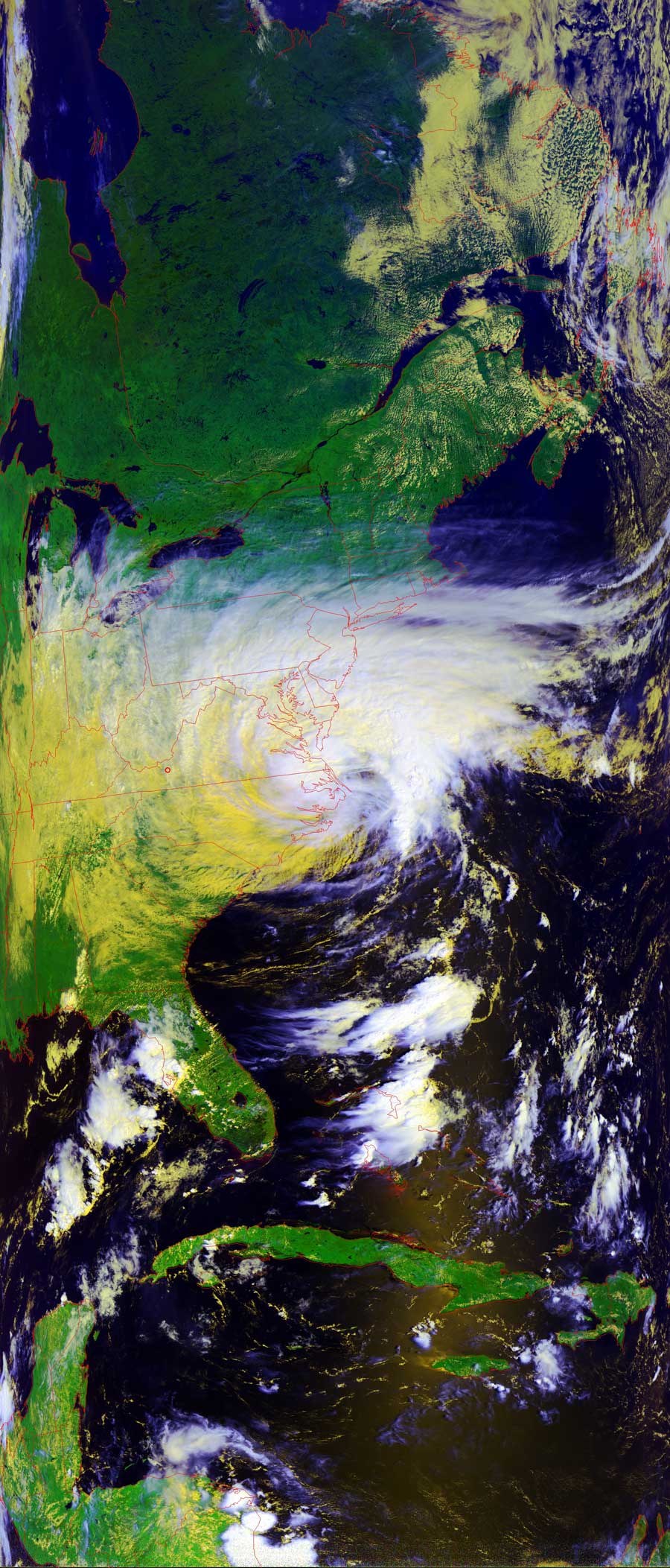
Satellites: NOAA-15 and NOAA-17, part of NOAA's 850km-high (530 mile-high) Polar Orbiting satellites
Ernesto is still a tropical storm--he apparently did not draw
enough power from the warm waters off the mid-Atlantic shore to upgrade into a
hurrixane.
The image below is a false color RGB (red, green, blue) image which brings out
the different cloud layers in the storm. The highest clouds are the brightest,
and the lower clouds are a yellowish color.
Stay tuned.
Click on the image below for a larger (>200k) image.