|
|
|
|
|
|
|
|
![]()
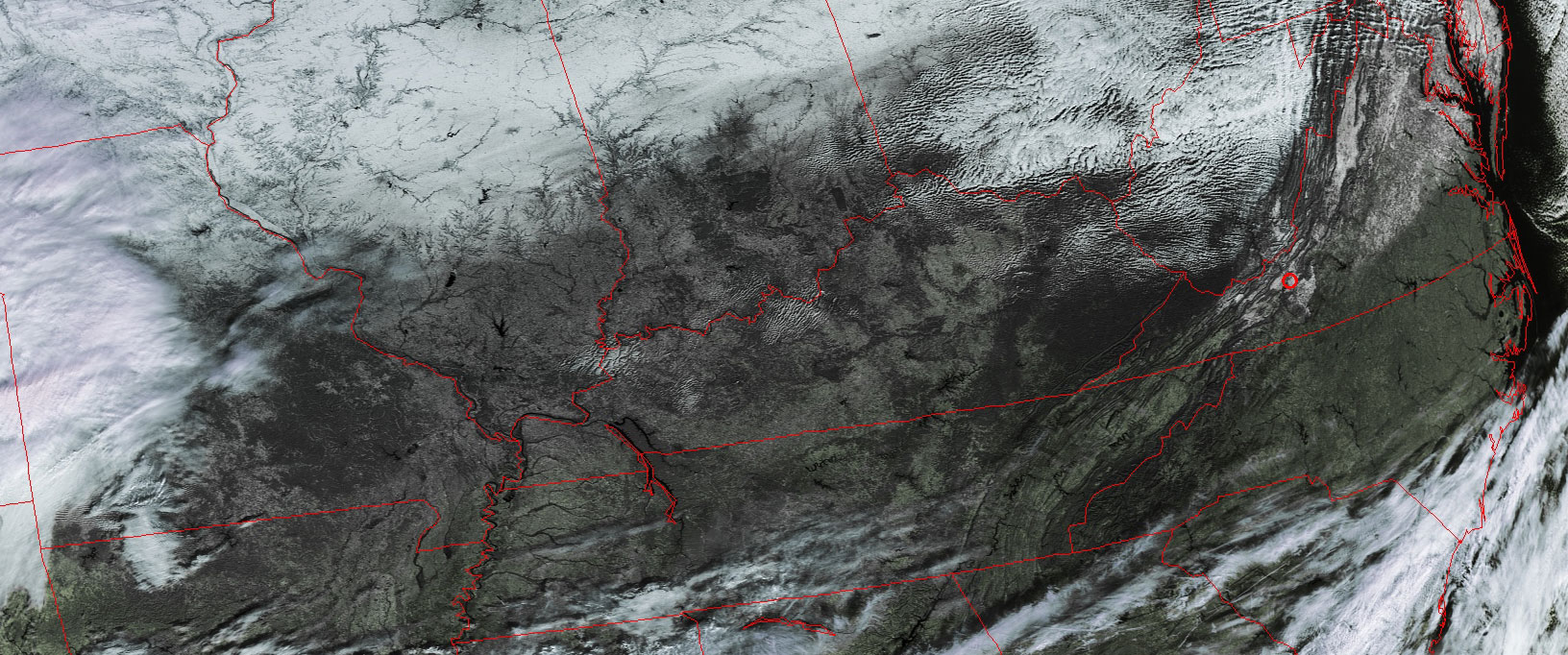
Satellites: NOAA-15 and NOAA-17, part of NOAA's 850km-high (530 mile-high) Polar Orbiting satellites
Once again, moisture-laden air from the Gulf of Mexico is
heading to the southeast.
Depending on when it meets the cold air coming down from Canada, this will make
rain or sleet or snow, or some combination of these elements.
If you look closely, you can see the "snow line" going from Illinois to Indiana
and going eastward.
Clicking on the image below gets you to a very high resolution image showing
this demarcation line.
If you look closely at that high-res image, you can almost imagine
seeing footprints in the snow!
The rivers and mountains are certainly outlined well in that image.
Click on the image below for a higher-resolution (350k) version.