|
|
|
|
|
|
|
|
|
The link above takes you to the
Weather Underground's
Radford University page that shows our weather data, updated every 5
minutes. There, you can also find the data archived in text format.
|
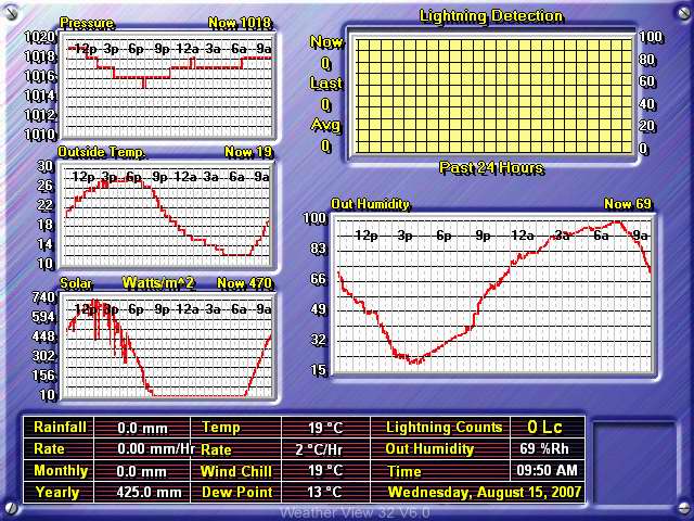
The image below is a live weather readout from the
Texas Weather Instruments WRL-32S weather station located on the top of
Curie Hall.
|
![]()
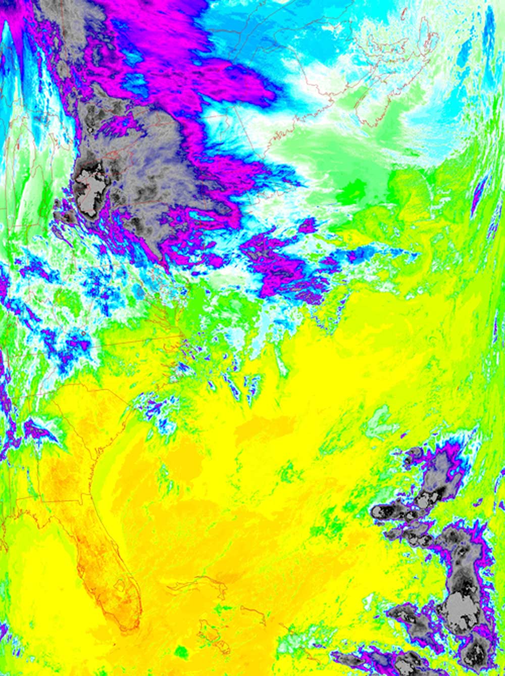
Satellites: NOAA-15 and NOAA-17, part of NOAA's 850km-high (530 mile-high) Polar Orbiting satellites
Fronts Collide
A weak warm front came from the gulf and collided with a cold front from Canada producing some precipitation in the northeast.
The black and dark grey areas are the coldest and tallest parts of the clouds.
This made for some pretty warm and windy conditions for the Radford area but no precipitation.
You can see Florida sitting down there, relaxing in the warm and dry air.
Click below for a higher-resolution version of this thermal image.