|
|
|
|
|
|
|
|
|
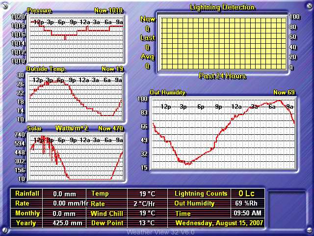
The link above takes you to the
Weather Underground's
Radford University page that shows our weather data, updated every 5
minutes. There, you can also find the data archived in text format.
|
The image below is a live weather readout from the
Texas Weather Instruments WRL-32S weather station located on the top of
Curie Hall.
|
![]()
Satellites: NOAA-15 and NOAA-17, part of NOAA's 850km-high (530 mile-high) Polar Orbiting satellites
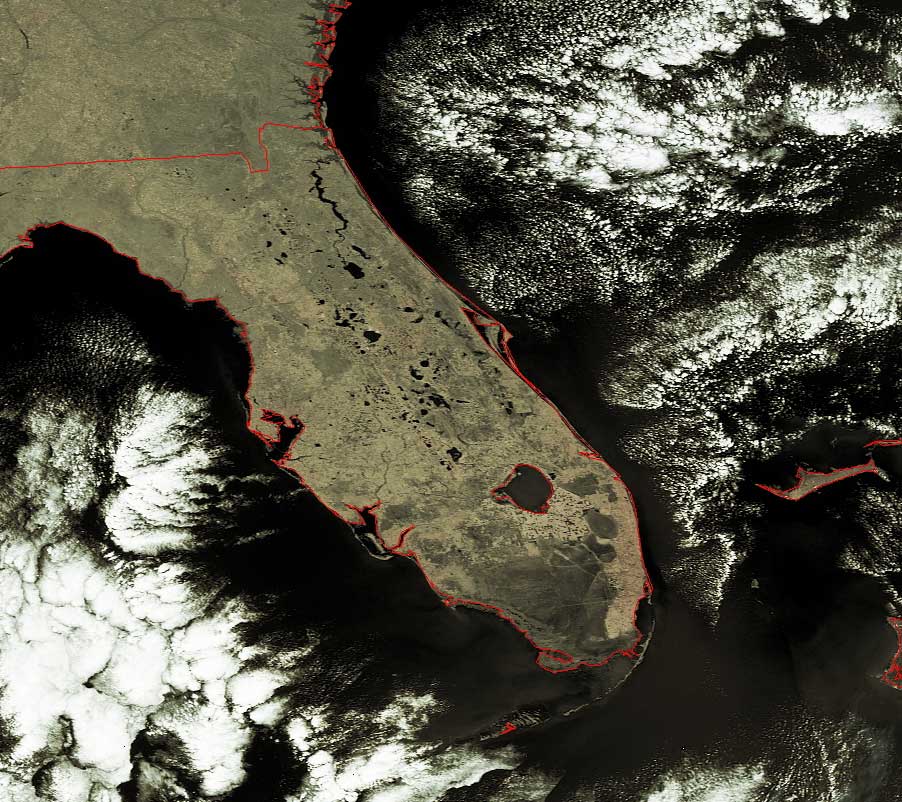
Human Encroachment and the Everglades
The image below was taken on Wednesday October 26, after Wilma had cleared out
of Florida.
She left as great deal of water on Florida in her aftermath, water that the
Florida Everglades is well-designed to handle.
In this image, the Everglade swamps and marshes are in the dark area in the
south of Florida, and you can see human activity especially to the east and
north as the well-delineated lighter-colored areas.
Note especially the straight lines in this and the high-resolution image:
These are roads cris-crossing the Everglades!
In recent years, people have recognized how essential the Everglades are
for the health of the whole of Florida--they provide a large natural water
filtration system., protection from flooding and fires, and a home to a huge
number of plant and animal species, many of which are endangered.
Click on the image below for a higher-resolution version.