|
|
|
|
|
|
|
|
|
The link above takes you to the
Weather Underground's
Radford University page that shows our weather data, updated every 5
minutes. There, you can also find the data archived in text format.
|
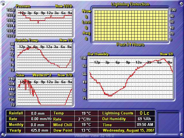
The image below is a live weather readout from the
Texas Weather Instruments WRL-32S weather station located on the top of
Curie Hall.
|
![]()
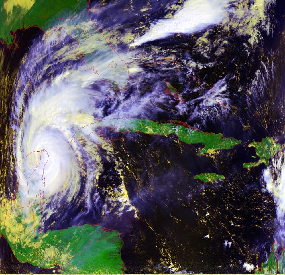
Satellites: NOAA-15 and NOAA-17, part of NOAA's 850km-high (530 mile-high) Polar Orbiting satellites
Wilma makes first landfall
Wilma makes her first landfall on the "Mexican Riviera."
As she churns her way slowly into the Gulf of Mexico, scraping across this land,
however briefly, may weaken her just a bit.
However, once she encounters the warm waters of the Gulf, she will again draw
power from that warmth and spin up to a Category 5.
Forecasters are still unsure about where she will make landfall on the US--too
many factors are in play here, including the jet stream, seen dipping down into
the US from Canada.
Note how the cold front ahead of the jet stream is causing the moisture Wilma is
pumping into the US southeast to come out of the air and bring rain.
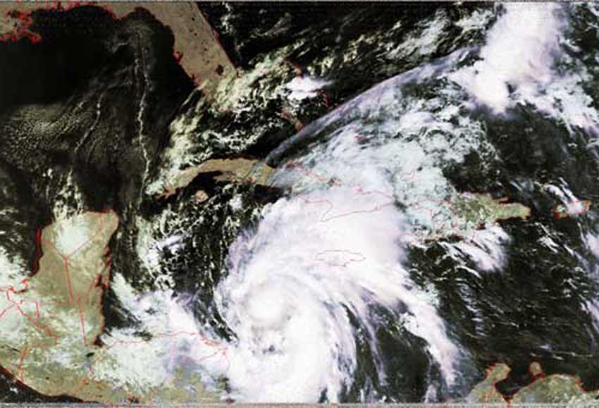
Click on the image below for a larger (>100k) image (a closer image of Wilma).

