|
|
|
|

![]()
Satellite
Image of the Day: October 19th,
2005
(click
here for previous images of the day from
RUSMART)
NOAA's
Hydrometeorologial Prediction
Center (HPC)
"Daily
National Forecast" image shows a daily national weather prediction
Satellites: NOAA-15 and NOAA-17, part of NOAA's 850km-high (530 mile-high) Polar Orbiting satellites
JUST ANOTHER HURRICANE!!
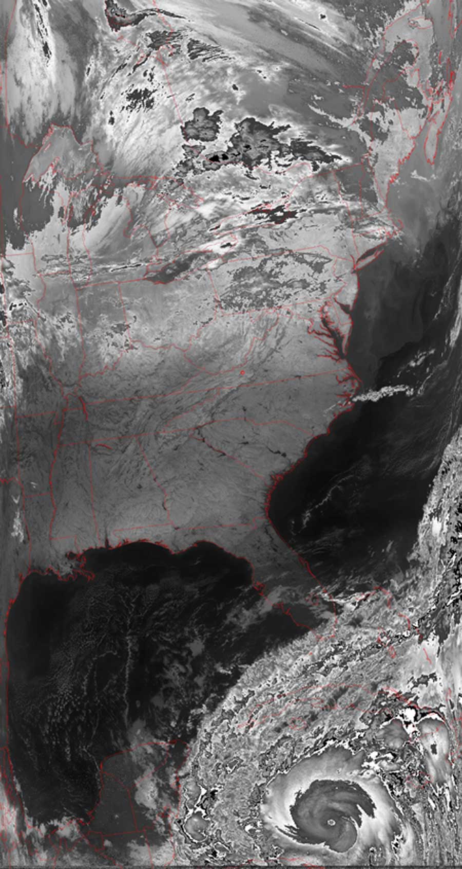
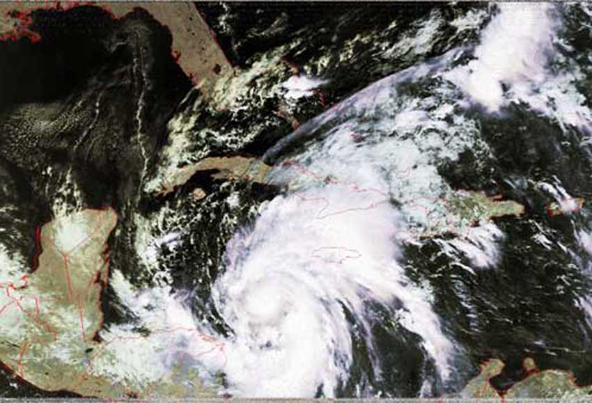
This is an NOAA, HE algorithm picture of the eastern half of the United States and the Gulf of Mexico.
You can see that there is some clouds and probably some precipitation around the Great Lakes area.
The Southeast looks pretty clear and dry for the moment.
Hurricane Wilma is making her way into the warm Gulf where she is expected to strengthen.
There seems to be a little eye forming in the center of Wilma's circulation.
You can see the counter-clockwise circulation caused by the Coriolis Effect.
Early models show that Wilma will turn to the Northeast and hit the Western side of Florida.