|
|
|
|

|
The link above takes you to the Weather Underground's Radford
University page that shows our weather data, updated every 5 minutes.
There, you can also find the data archived in text format.
|
The image below is a live weather readout from
the Texas Weather Instruments
WRL-32S weather station located on the top of Curie Hall.
|


![]()
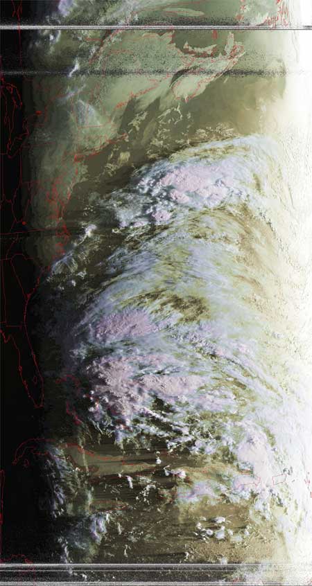
Satellite
Image of the Day: October 5th,
2005
(click
here for previous images of the day from RUSMART)
NOAA's Hydrometeorologial Prediction
Center (HPC) "Daily
National Forecast" image shows a daily national weather prediction
Satellites: NOAA-15 and NOAA-17, part of NOAA's 850km-high (530 mile-high) Polar Orbiting
satellites
|
|
Notice off the coast of Florida the
purplish colored high clouds.
|
|
|
This poorly-defined low pressure system
would later evolve into Tropical Storm Tammy
|
|
|
Currently, Tammy's winds are about 40mph, and she is soon expected to make landfall near the FL-GA border where she will fizzle into a Tropical Depression, then fade away. |