|
|
|
|
|
|
|
|

Satellites: NOAA-15
and NOAA-17,
part of NOAA's 850km-high (530 mile-high) Polar
Orbiting satellites
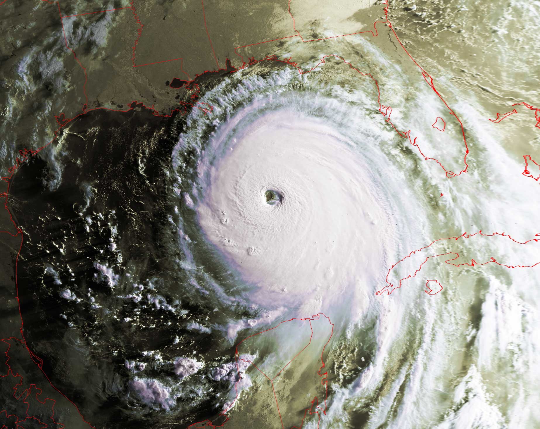
The aftermath of Katrina
Hurricane Katrina powered up when she crossed southern Florida
and hit the very warm (~90 degrees Fahrenheit) waters of the Gulf of Mexico.
Hurricanes draw their power from heat energy released from the warm waters lying
below them.
Click on the image(s) below for a higher-resolution (~100k) picture.
**For a very high resolution (nearly 300k) picture of Katrina's eye
on Sunday. Aug. 28, click here.
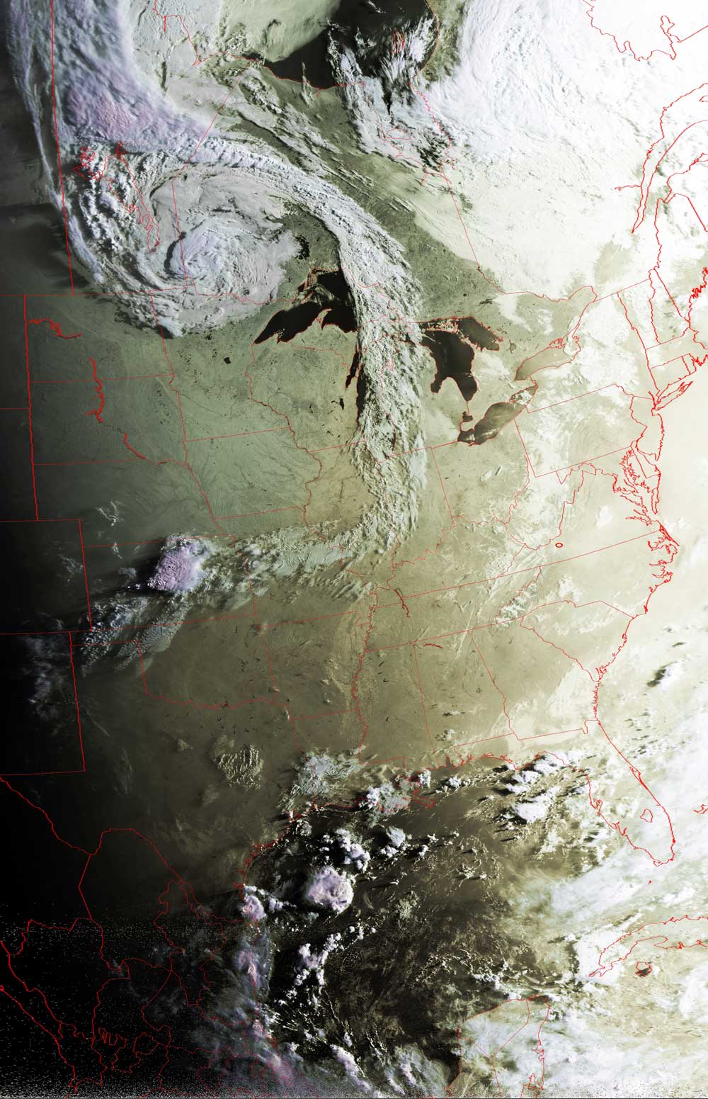
| Wednesday evening, August 31: The evening (just after 8pm eastern time) shadows reveal the swollen banks of Lake Pontchartrain. The submerged city of New Orleans is the dark spot just southwest of Lake Pontchartrain, between the Mississippi River and the lake. The reason New Orleans is visible in this image is that the flooding has made it look like a lake itself. | Thursday morning, September 1: Katrina is all but gone, having followed the eastern seaboard north to fizzle out over the Pennsylvania-New York area. The mid-latitude system to the northwest of the Great Lakes is not a part of any of Katrina's remnant. |
|
|
 |
