|
|
|
|
|
|
|
|

Satellites: NOAA-15
and NOAA-17,
part of NOAA's 850km-high (530 mile-high) Polar
Orbiting satellites
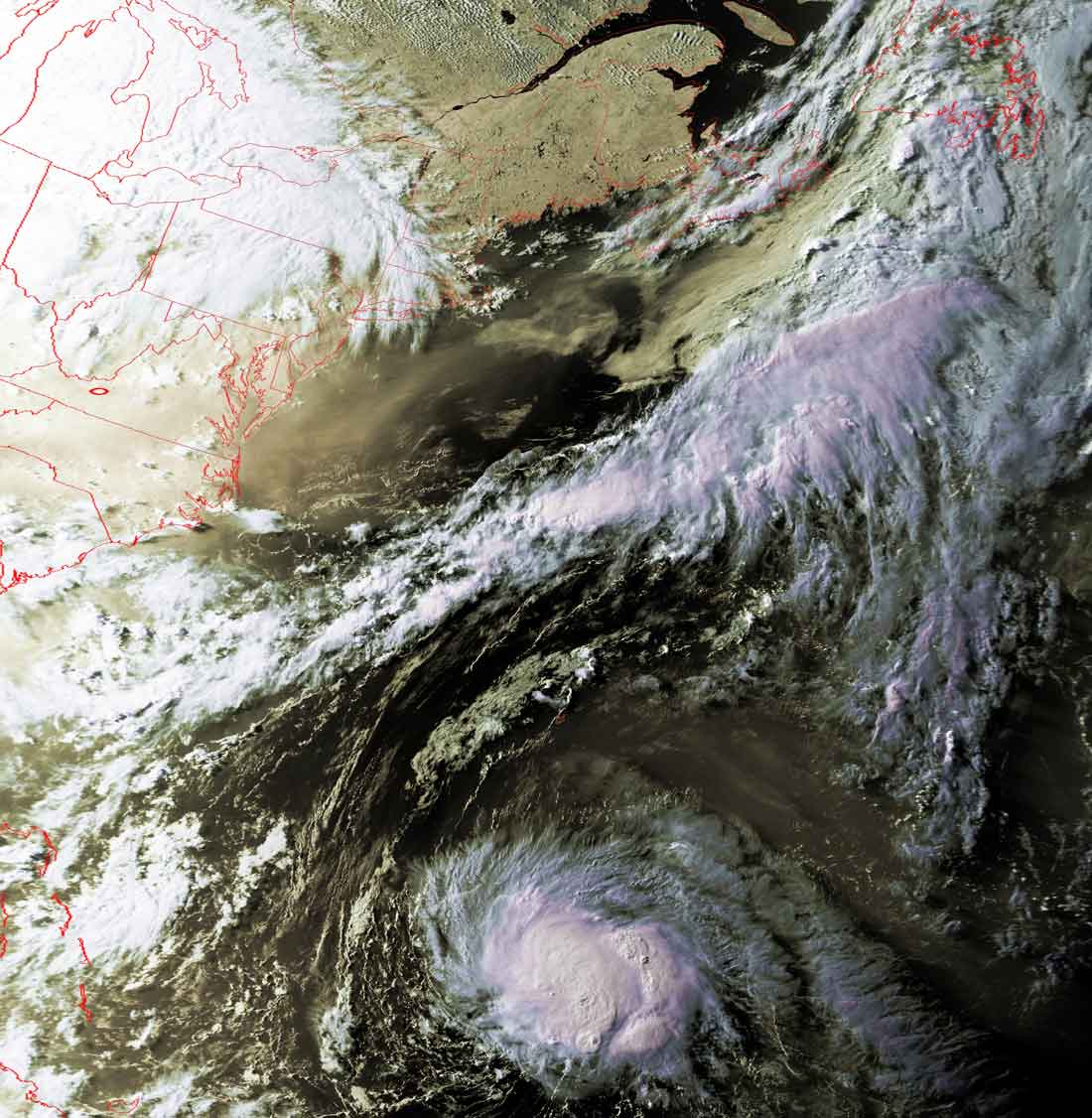
Irene
Way out in the Atlantic Ocean, Irene seemed to be breaking up.
Now, however, she seems to be reconsolidating, possibly powering back up to
eventually reach hurricane status.
This image was obtained Thursday evening, as can be seen by the angle of the sun
in this image.
Click on the image(s) below for a higher-resolution (~100k) picture.