|
|
|
|
|
|
|
|

Satellites: NOAA-15
and NOAA-17,
part of NOAA's 850km-high (530 mile-high) Polar
Orbiting satellites
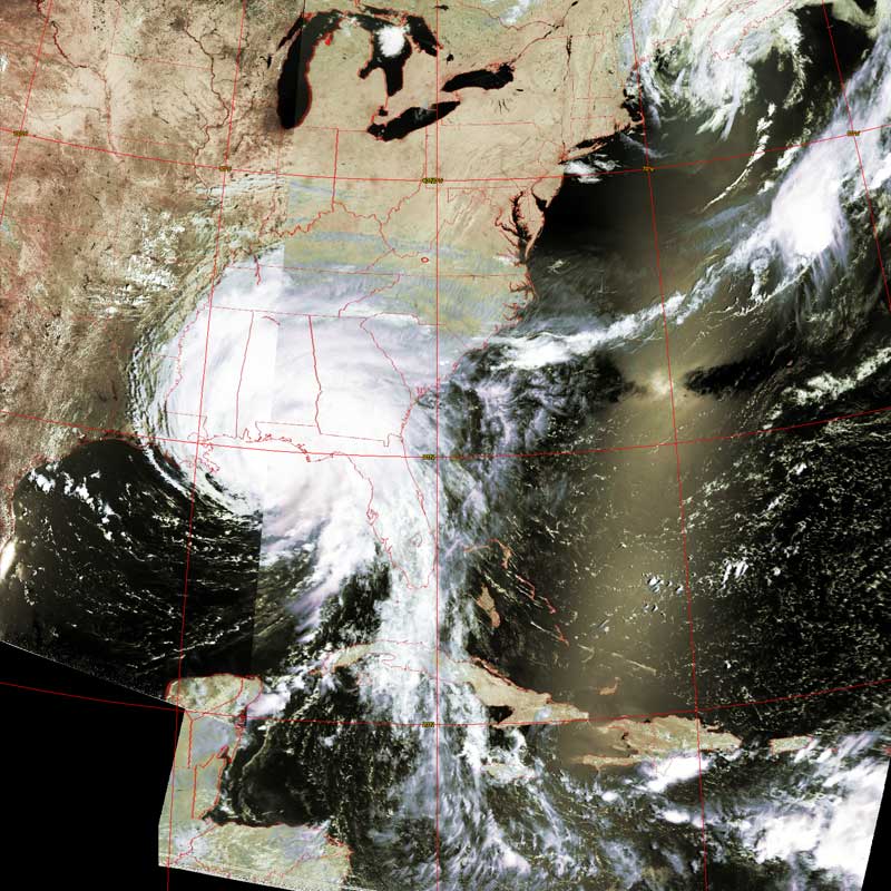
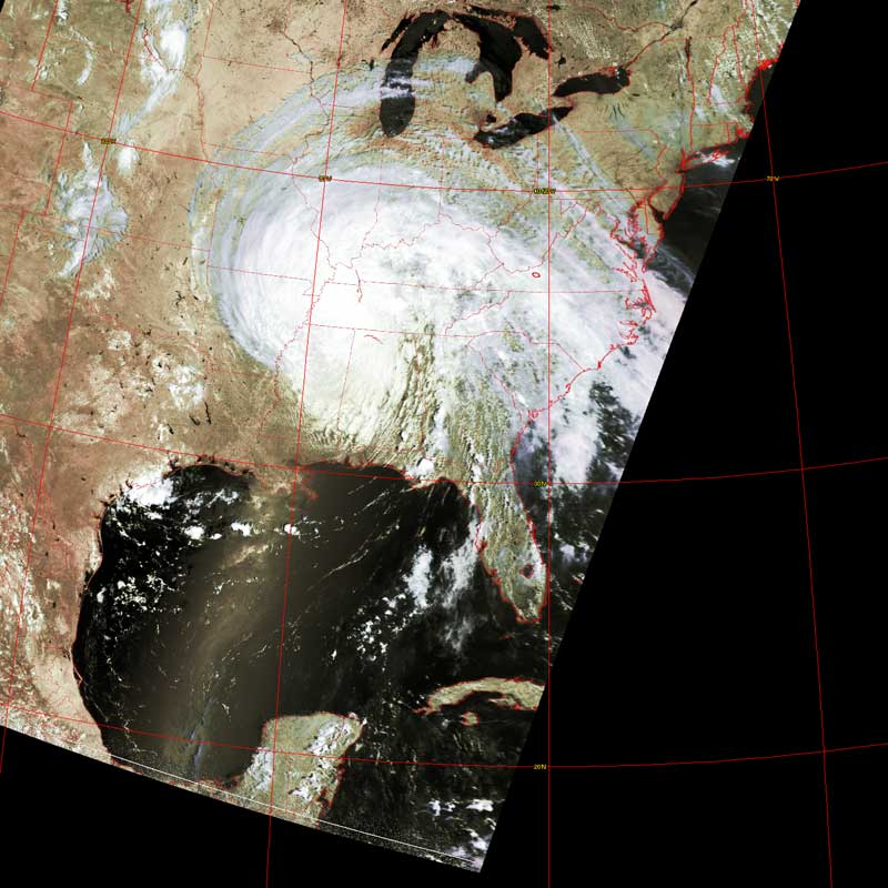
Rise and fall of Dennis
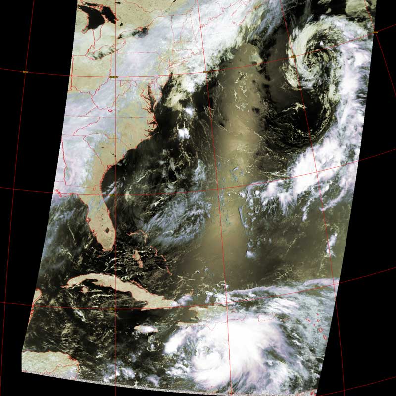
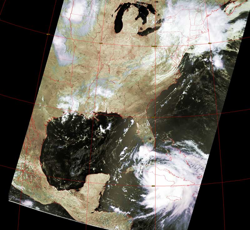
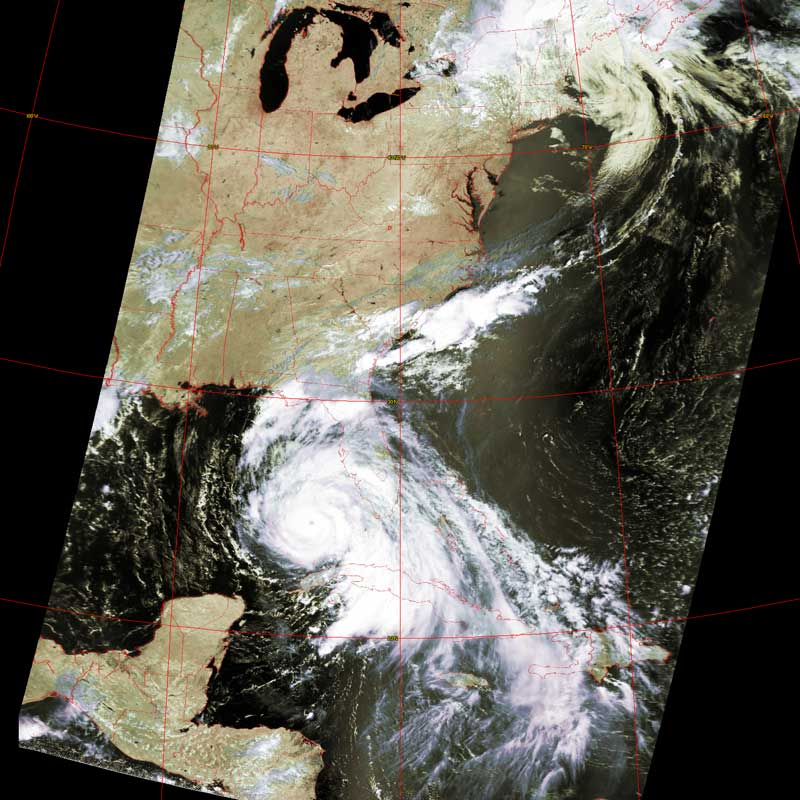
This series of images taken over the course of 6 days shows the
development of Hurricane Dennis.
Dennis was less consolidated on July 6 when it was heading towards Cuba.
By July 7, Dennis had consolidated to make the first hurricane of the season.
Dennis followed the usual general route taken by tropical storms/hurricanes:
1. Starting off heading westward...
2. ...turning north in response to the mid-latitude westerly winds...
3. ...and then trying to head east.
Dennis lost most of his power over land and finished up as a large storm system
over the midwest.
Click on the image(s) below for a higher-resolution (~100k) picture.
|
July 6 |
July 7 |
 |
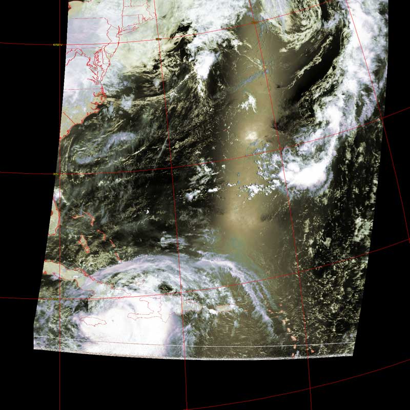 |
| July 8 | July 9 |
 |
 |
| July 10 | July 11 |
 |
 |
