
![]()
|
|
|
|

Satellites: NOAA-15
and NOAA-17,
part of NOAA's 850km-high (530 mile-high) Polar
Orbiting satellites
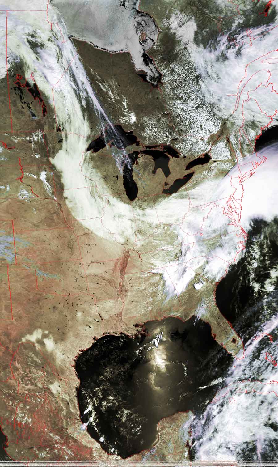
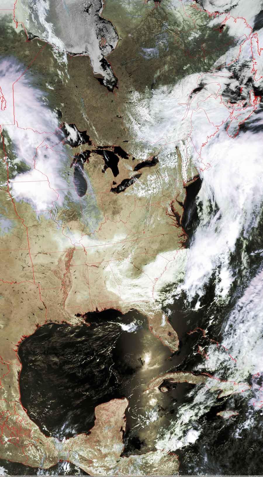
Storm Front
These two images show how the Canadian jet stream dips
down and drives many weather patterns across the US from west to east.
In yesterday's picture, this pattern pulled moisture up from the Gulf of Mexico,
causing thunderstorms across the mid-atlantic states.
In today's image, those storms have broken off from the stream, leaving clear
skies in their wake.
These images also show the path of the satellite as it moves from north to
south--the sun was right behind the satellite when it flew across the Gulf of
Mexico.
Note that you can also see the remnants of
Hurricane Adrian moving northeastward from the Yucatan Peninsula.
Adrian had the rare distinction of striking the Central American coast from the
Pacific side.
Click on the images below for a higher-resolution (>100k) version.
| May 20, 2005 | May 21, 2005 |
 |
 |