![]()
|
|
|
|

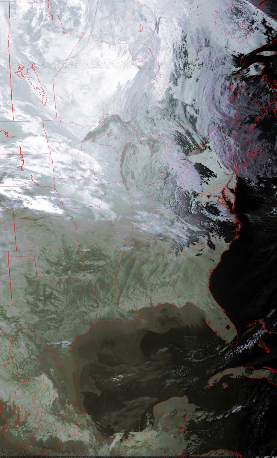
Satellites: NOAA-15
and NOAA-17,
part of NOAA's 850km-high (530 mile-high) Polar
Orbiting satellites
Seeing in the dark
This image is a false color image created with extra
emphasis on one of the infrared channels. This allows for "seeing in the dark."
The very dark places in the mid-atlantic states are where early-morning snow had
already fallen, and where the cold clouds were still overhead.
Note especially the details revealed in the Gulf of Mexico: The lighter places
in the water--nearest the land--are the cooler patches of water. This is where
the water has run off of the cold land mass.
Note how the deeper water, the darker water, is warmer, showing how larger
bodies of water act to resist large temperature variations near/around them.
The twists and turns of the jet stream may be seen in the northeast.
Click on the image below for a higher-resolution (>100k) version.