
![]()
|
|
|
|

Satellites: NOAA-15
and NOAA-17,
part of NOAA's 850km-high (530 mile-high) Polar
Orbiting satellites
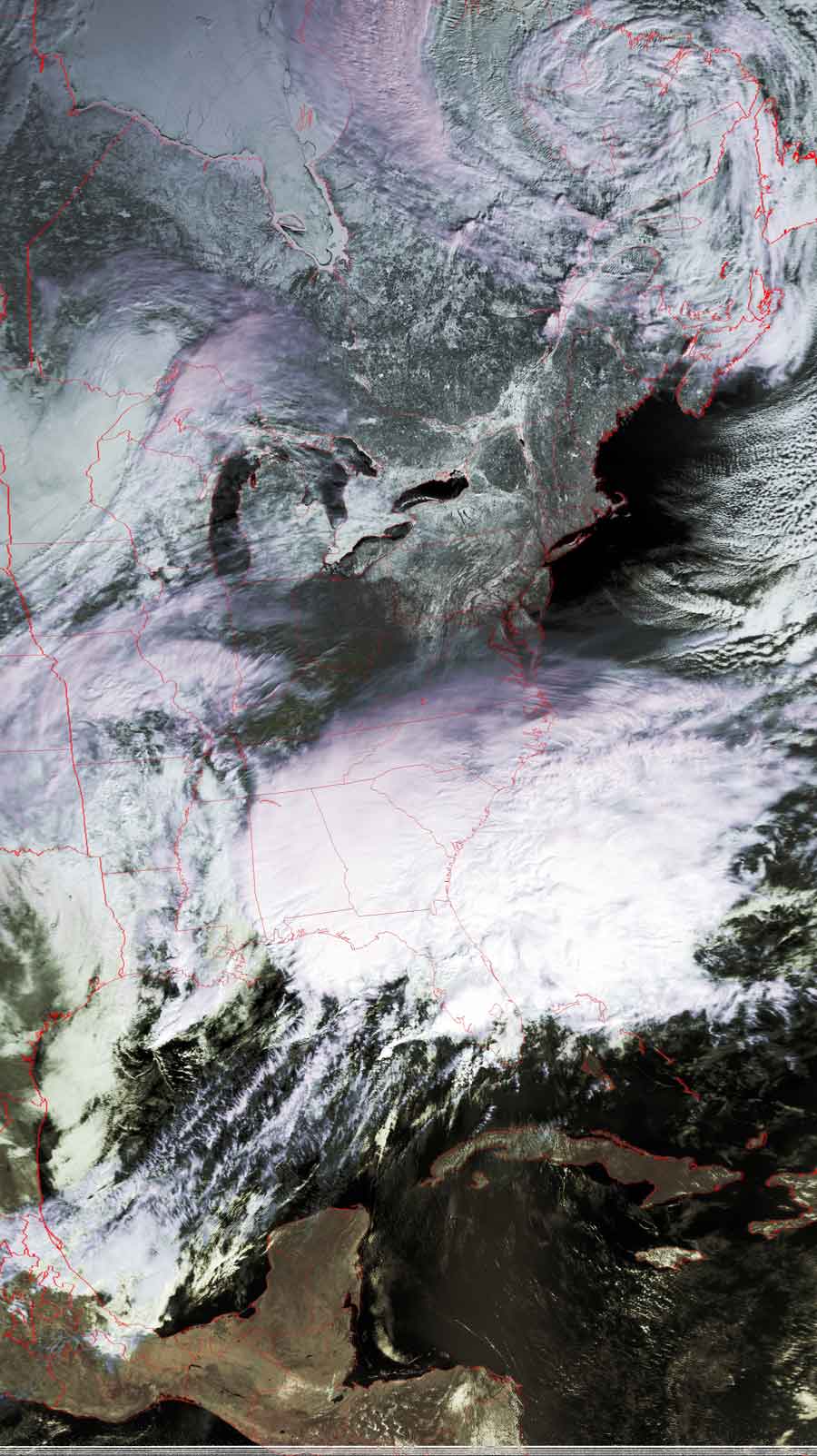
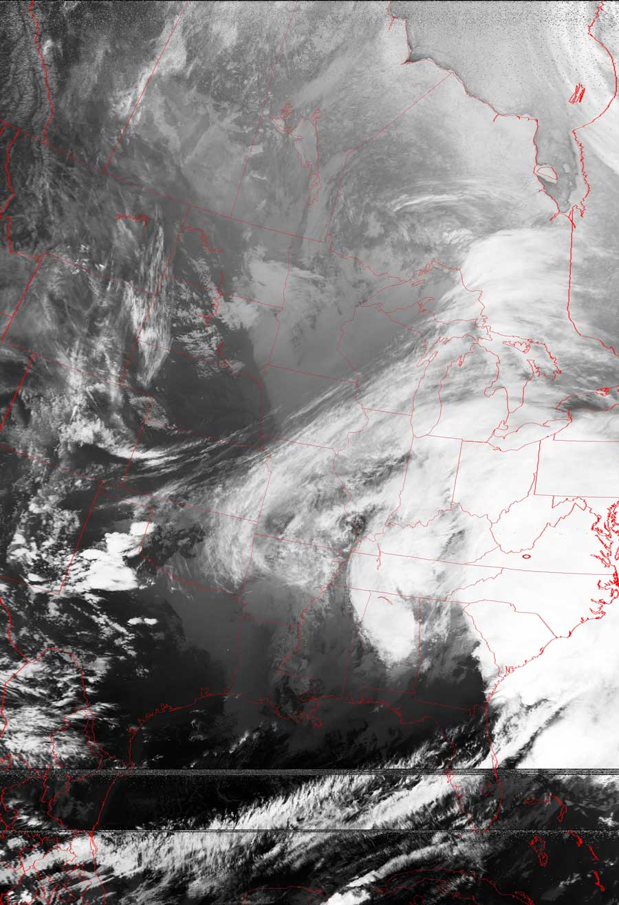
Storm A-comin'...yet again...
These two images, taken approximately 8 hours apart,
show the storm that is coming to the mid-atlantic states.
The first image at the left shows the jet stream as it has started to push its
way down across Minnesota, pushing the cold front along with it.
The moist air ahead of that cold front is predicted to drop a whole of of frozen
precipitation (mostly snow, some ice) on the mid-atlantic states.
Click on the images below for a higher-resolution (>100k) version.
|
Image acquired~11:00am Note the jet stream pushing down through Minnesota, as well as the moisture that has been drawn northward from the Gulf of Mexico. |
Image acquired~9:00pm This infrared image (taken at night) clearly shows the jet stream dipping quite far south over the Dakotas and Minnesota, pushing a snowstorm ahead of it. |
 |
 |