
![]()
|
|
|
|

Satellites: NOAA-15
and NOAA-17,
part of NOAA's 850km-high (530 mile-high) Polar
Orbiting satellites
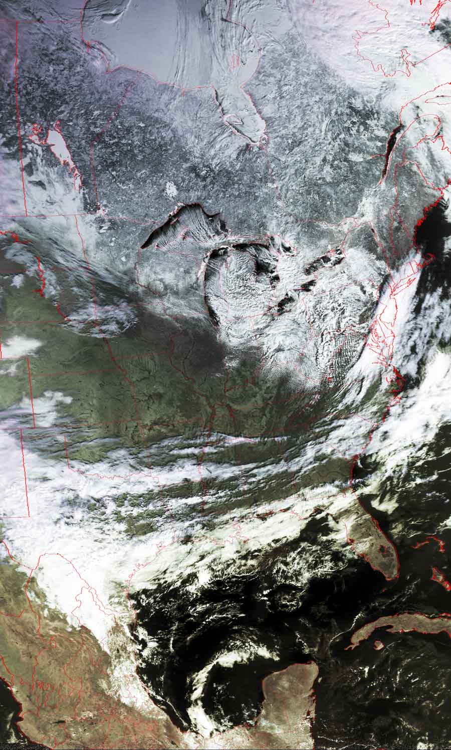
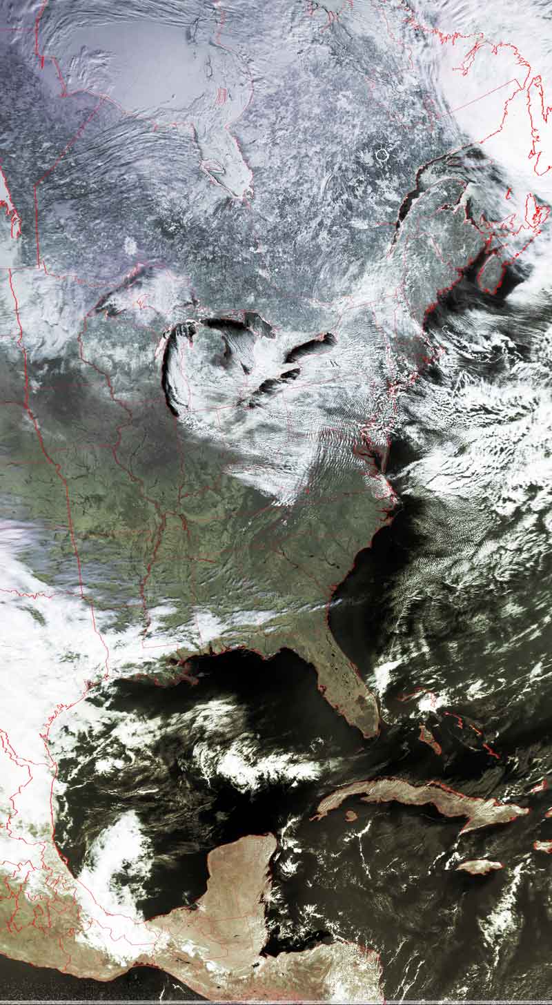
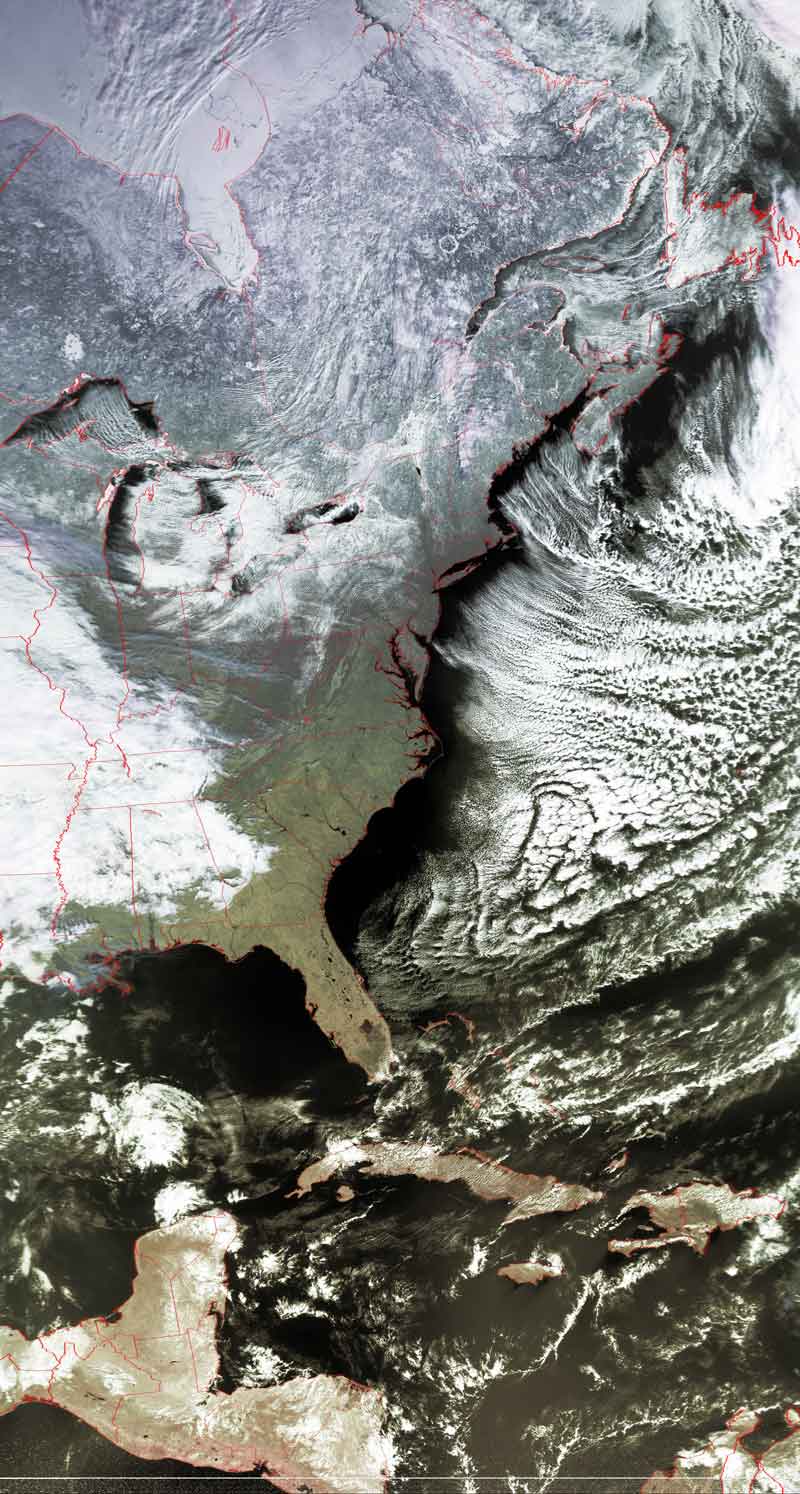
Jet Stream drives weather eastward
The jet stream crosses over much of the northern US,
while the "westerlies" blow wet air across the southern states.
This series of three images shows the development of a large weather system as
the jet stream drives it across the country.
This is a classic example of just how strong the jet stream is, dragging whole
systems with it even as far south as Texas.
The "westerlies" are called that because they blow from the west.
Here, these "westerlies" are also known as the "southern jet stream."
Click on the images below for a higher-resolution (>100k) version.
| February 17 | February 18 | February 19 |
 |
 |
 |