
![]()
|
|
|
|

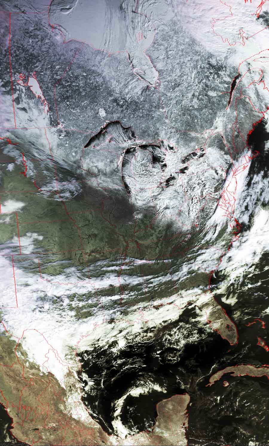
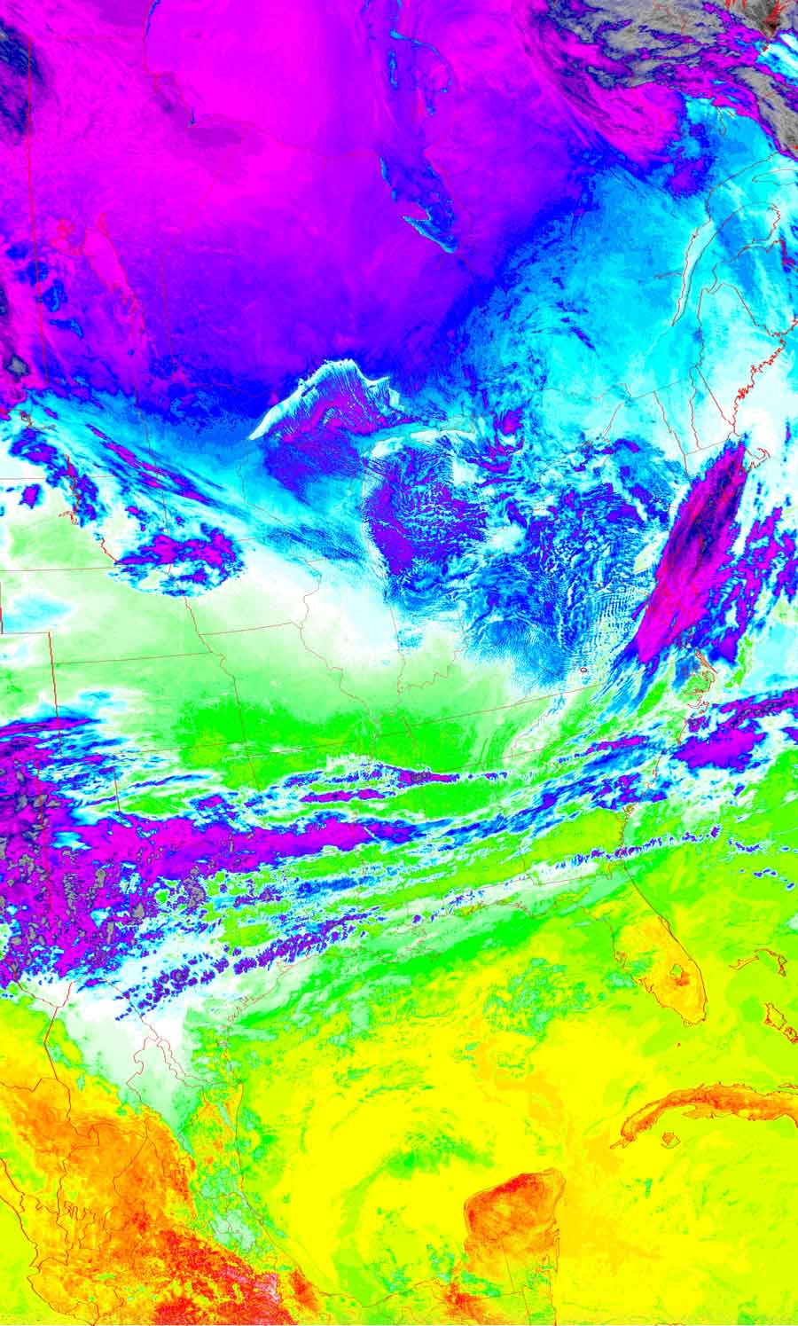
Satellites: NOAA-15
and NOAA-17,
part of NOAA's 850km-high (530 mile-high) Polar
Orbiting satellites
Jet Stream influences the nation's weather
The jet stream crosses over much of the northern US,
while the "westerlies" blow wet air across the southern states.
This combination could bring any combination of snow/ice/rain to the eastern US,
depending on the relative orientation of the two influences.
At the moment, this combination is bringing very clear skies to the mid-latitude
states.
The "westerlies" are called that because they blow from the west.
Click on the images below for a higher-resolution (>100k) version.
| False color image | Thermal image |
 |
  |