
![]()
|
|
|
|

Satellites: NOAA-15
and NOAA-17,
part of NOAA's 850km-high (530 mile-high) Polar
Orbiting satellites
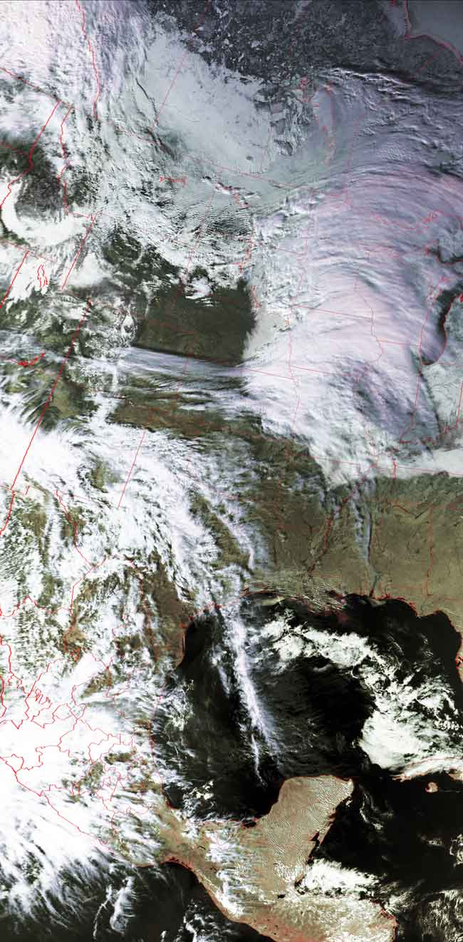
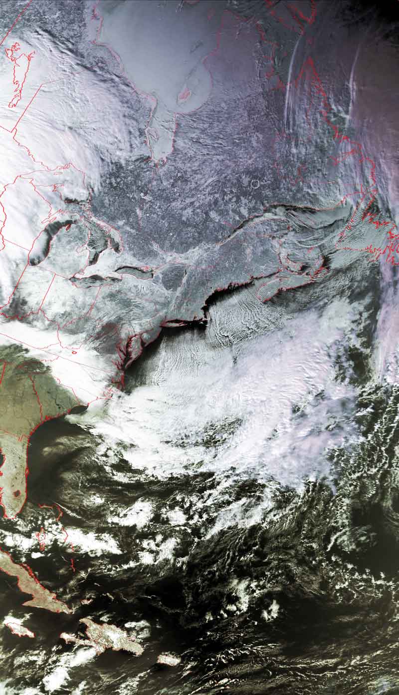
The jet stream brings winter to the southeast
These two images were taken 90 minutes apart by
NOAA-16.
They show the path of the jet stream as it undulates north and south in its
eastern progression.
In the rightmost image, the stream has dipped down through the Great Lakes
region all the way down to the mid-Atlantic states, bringing with it a midday
cooling of the area.
Throughout the day (Friday, Jan. 21) temperatures fell from their "morning
highs."
The path of the snow that hit the upper eastern part of the US may be seen
clearly.
Click on the images below for a higher-resolution (>100k) version.
| Image acquired around 3:18pm. | Image acquired around 1:37pm. |
 |
 |