![]()
|
|
|
|

Satellites: NOAA-15
and NOAA-17,
part of NOAA's 850km-high (530 mile-high) Polar
Orbiting satellites
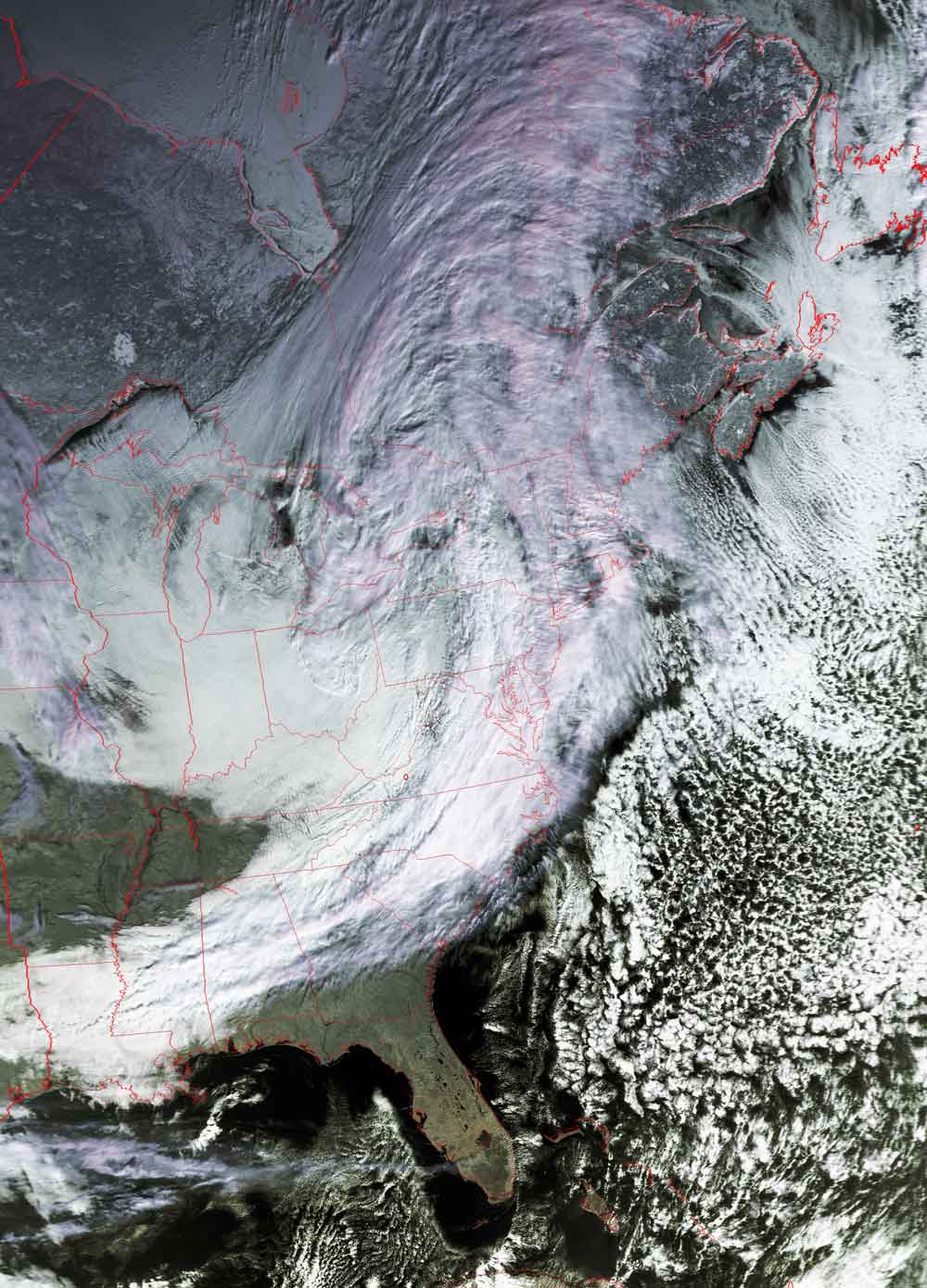
After yesterday's cold front moved into the southeast...now
comes the snow.
Yesterday's cold front brought moving through collided
with the moist air moving up from the Gulf of Mexico.
This image shows the classic weather pattern that includes
(a) the counterclockwise circulation characteristic of mid-latitude northern
hemisphere systems,
(b) how that circulation brings the warmer moist air up from the Gulf, and
(c) how that circulation pas pulled arctic air into the southeast from the Upper
Plains states.
Put all those together, and...snow for the southeast!
Also note how this system is pulling moisture off of the northern Atlantic Ocean
and dumping it as snow in northeastern Canada.
Click on the image below for a higher-resolution (>100k) version.