
![]()
|
|
|
|

Satellites: NOAA-15
and NOAA-17,
part of NOAA's 850km-high (530 mile-high) Polar
Orbiting satellites
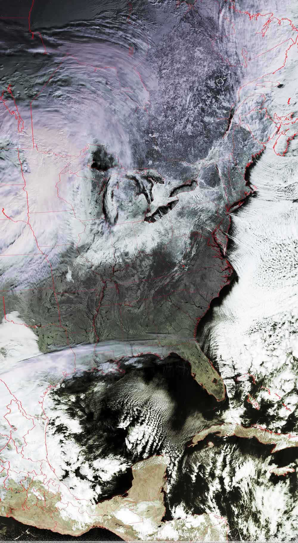
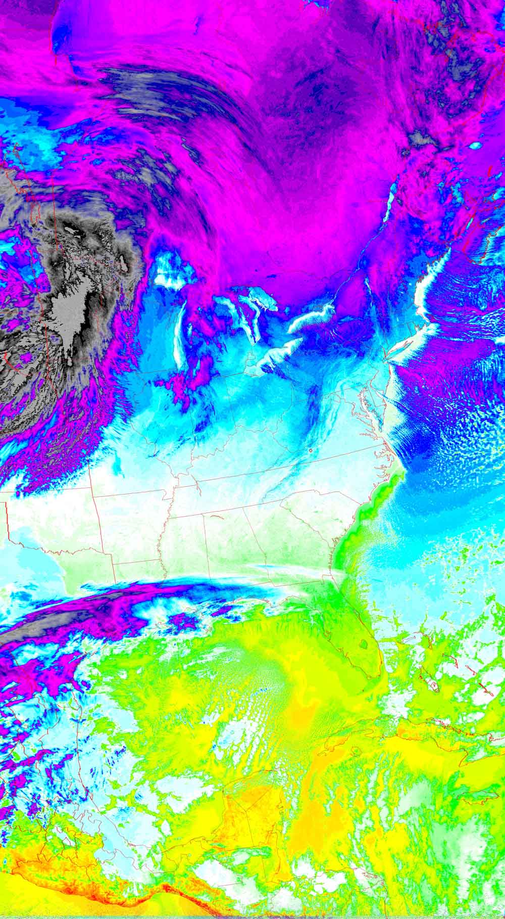
Br-r-r-r-r-r-r!!
A cold front moves into the southeast, finally
bringing winter to the area...really bringing it!
With skies being clear, you can see just how cold it was this morning, even at
this time around 11:30am.
Temperatures near 00F were common in areas not used to such things.
Click on the image below for a higher-resolution (>150k) version.
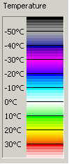
| False color image | Thermal image |
 |
  |