
![]()
|
|
|
|

Satellites: NOAA-15
and NOAA-17,
part of NOAA's 850km-high (530 mile-high) Polar
Orbiting satellites
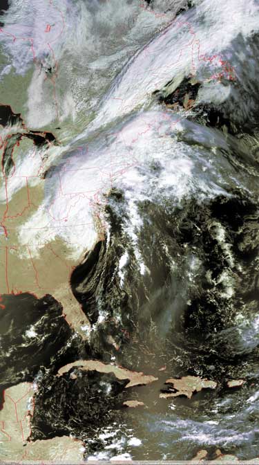
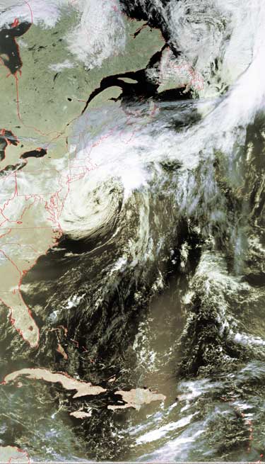
Tropical Storm Jeanne
makes her way up the eastern seaboard
Click on the images below for a higher-resolution (~100k) closeup of the
hurricane, showing the remarkable structure of the central, most powerful area.
In all of these images, there is a small red circle marking the location of
Radford University; specifically, the
location of Curie Hall and the RUSMART HRPT antenna.
|
Image by NOAA-17, flyover beginning 11:34am EDT, yesterday, Sept. 28 Jeanne is still swirling around, dumping much of her accumulated water as she makes her way north. |
Image by NOAA-17, flyover beginning 11:12am EDT today, Sept. 29 Jeanne is finally starting to turn out towards sea. Unfortunately, she is not turning all that quickly. |
 |
 |