
![]()
|
|
|
|

Satellites: NOAA-15
and NOAA-17,
part of NOAA's 850km-high (530 mile-high) Polar
Orbiting satellites
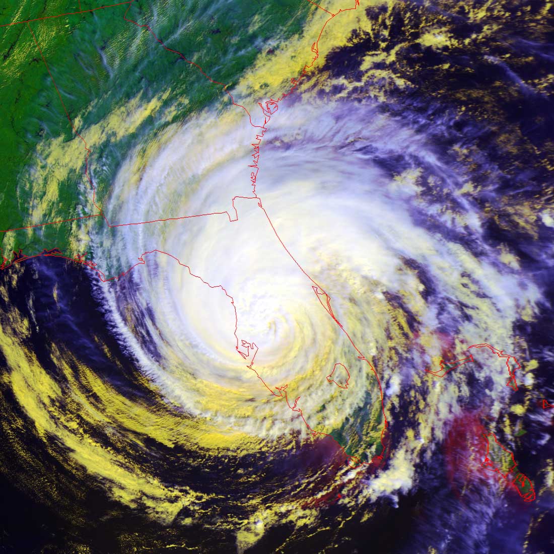
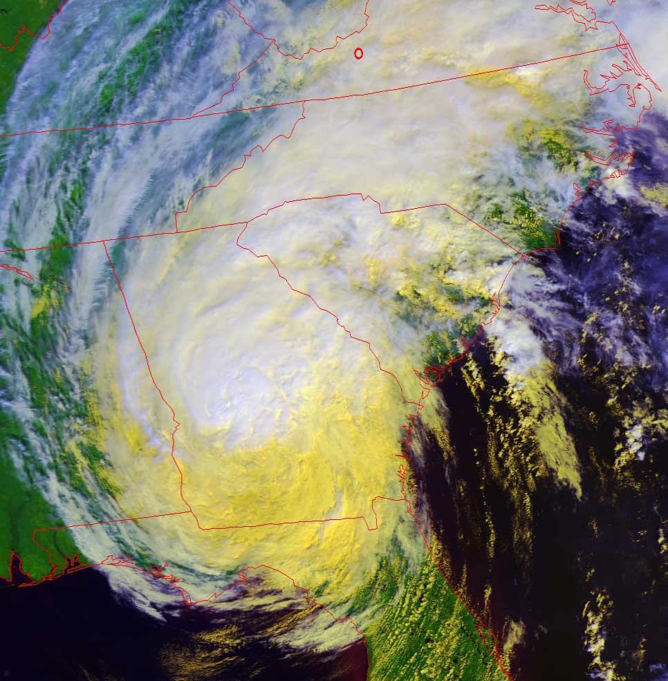
Tropical Storm Jeanne
makes her way up the southeastern coast
NOTE:
These
images were produced as a "false color RGB" image to bring out the structure of
the cloud formations.
In these images, the highest and coldest clouds are the whitest, while lower and
warmer clouds are yellow.
The land is unnaturally green--this is an artifact showing the relative warmth
of land.
Click on the images below for a higher-resolution (~100k) closeup of the
hurricane, showing the remarkable structure of the central, most powerful area.
In all of these images, there is a small red circle marking the location of
Radford University; specifically, the
location of Curie Hall and the RUSMART HRPT antenna.
|
Image by NOAA-17, flyover beginning 12:20pm EDT, yesterday, Sept. 26 In this image, Jeanne is still a hurricane, with a well-defined eye. Note how much of Jeanne is defined by a cover of high, very cold clouds (whiter in these RGB images). Hurricanes characteristically have those high, extremely cold (-1000F or colder!) clouds at their tops. |
Image by NOAA-17, flyover beginning 11:57am EDT today, Sept. 27 In this image, Jeanne has lost some of her power and is now a tropical storm. Still deadly and damaging, with relatively-high winds but mostly through torrential rain. Note how most of the higher, very cold clouds have dissipated. |
 |
 |