![]()
|
|
|
|

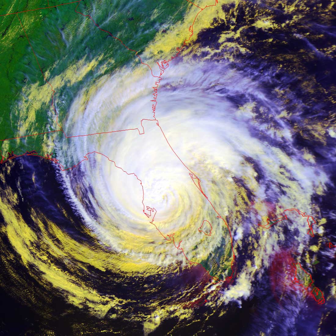
Satellites: NOAA-15
and NOAA-17,
part of NOAA's 850km-high (530 mile-high) Polar
Orbiting satellites
Hurricane Jeanne
right over Florida
Image by NOAA-17, flyover beginning 12:20pm EDT.
Jeanne made a rare extra turn and, after initially heading out towards the
middle of the Atlantic, she turned back around and re-emerged as a full
hurricane.
NOTE: This
image was produced as a "false color RGB" image to bring out the structure of
the cloud formations.
In these images, the highest and coldest clouds are the whitest, while lower and
warmer clouds are yellow.
The land is unnaturally green--this is an artifact showing the relative warmth
of land.
Click on the image below for a higher-resolution (~160k) closeup of the
hurricane, showing the remarkable structure of the central, most powerful area.