
![]()
|
|
|
|

Satellite: NOAA-15
and NOAA-17,
part of NOAA's 850km-high (530 mile-high) Polar
Orbiting satellites
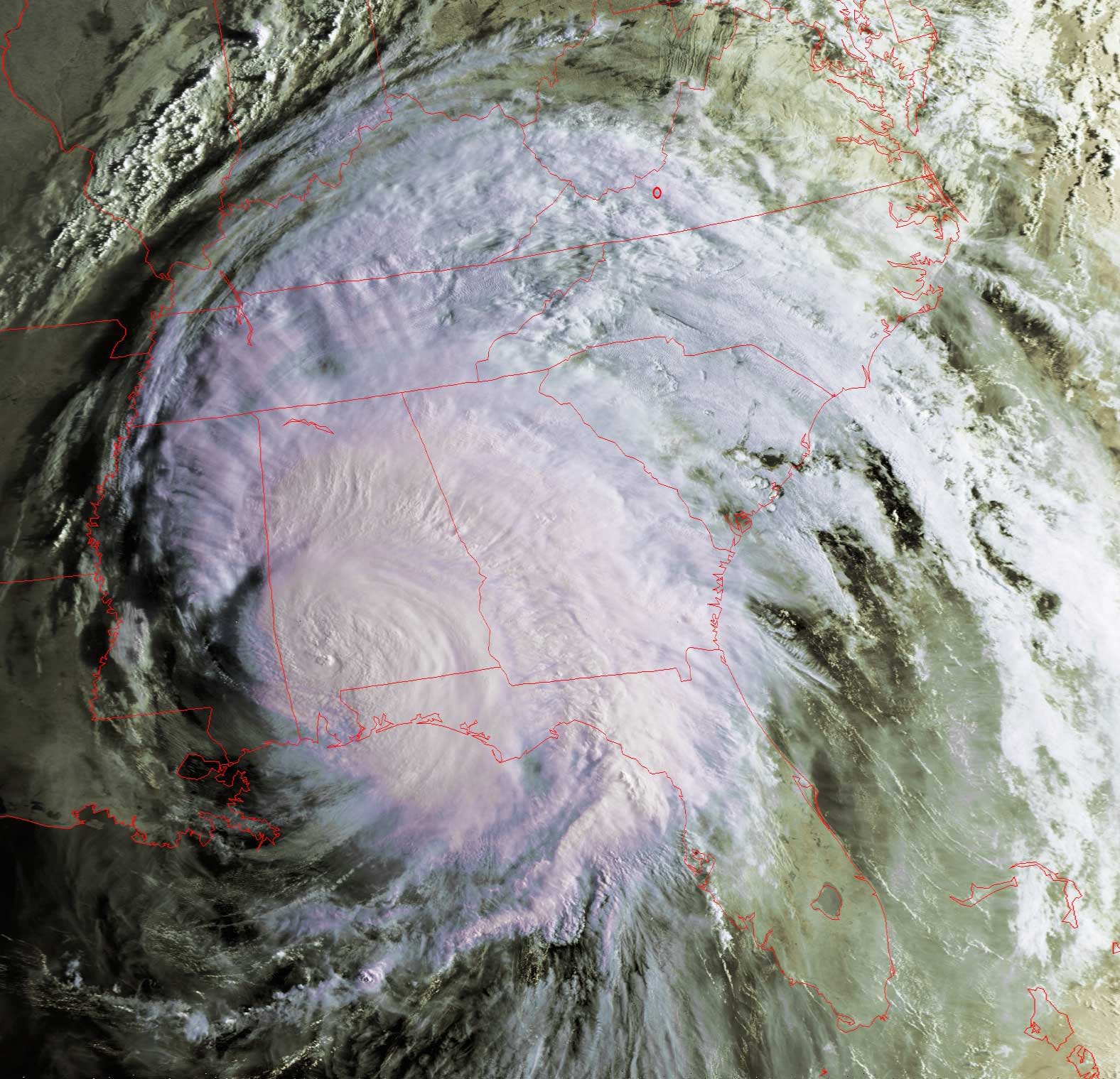
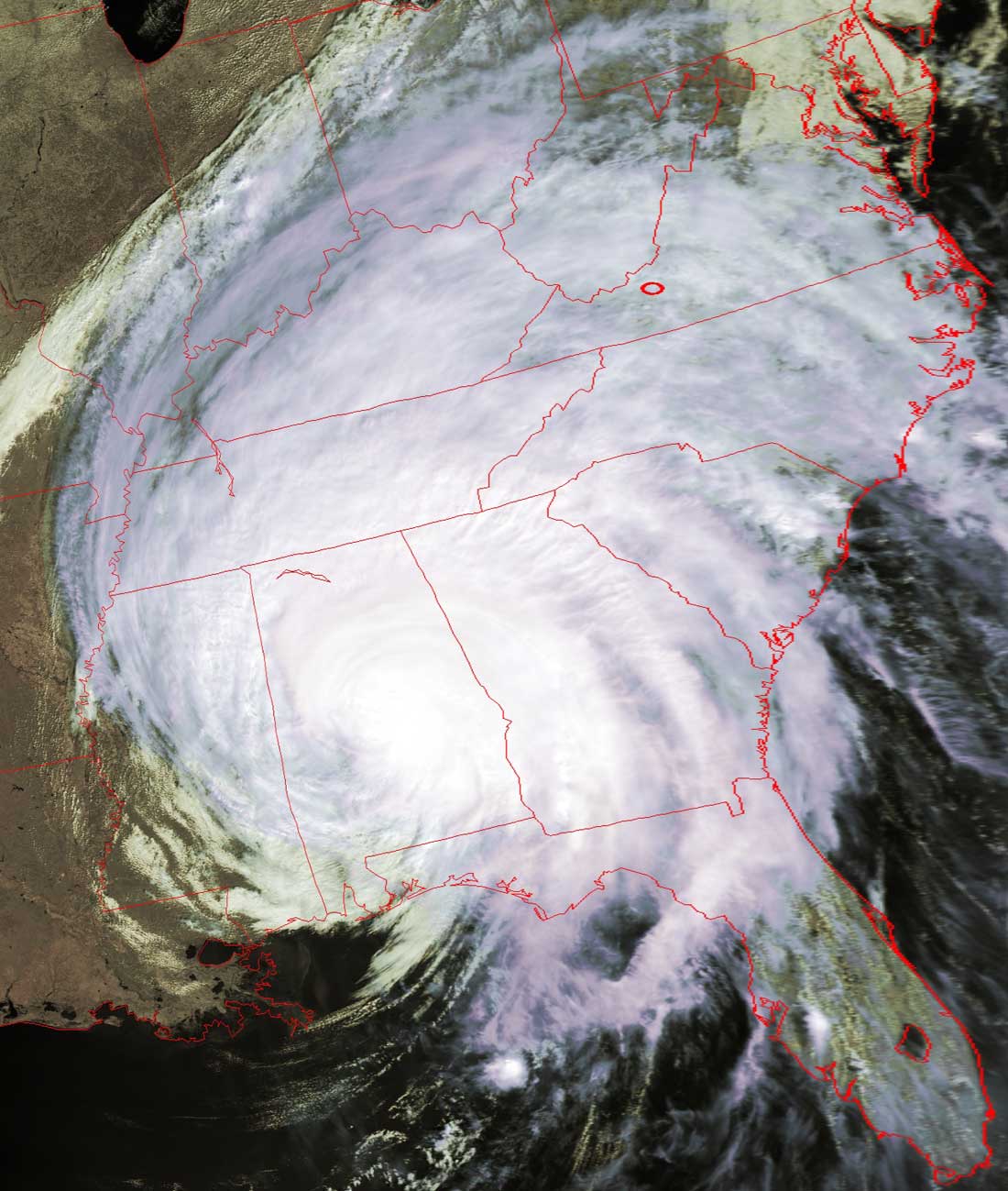
Hurricane Ivan Makes
Landfall
Ivan made landfall overnight, missing hitting New Orleans directly but slamming
into the Florida panhandle and Alabama.
Ivan is huge, altering the weather all over the southeast, and bringing a lot of
rain to the mid-Atlantic states.
You can see Ivan's cumulative path from the previous few
"Images of the Day".
Click on the images below to see a higher-resolution (>150k) version showing
only Ivan.
The small red circle marks the location of
Radford University; specifically, the location of Curie Hall and the RUSMART
antenna.
|
NOAA-15: Flyover beginning 8:09am EDT In this image, and the higher resolution image (click on the image below) you can see the class spoke pattern where Ivan is still drawing power from the surrounding warmer areas. The very-low-pressure region (eye) at the center of a hurricane is the engine that pulls in moisture from the surrounding, creating the monstrous swirling winds of the hurricane. |
NOAA-17: Flyover beginning 12:48pm EDT From the image this morning to this image, you can see how Ivan's hurricane eye has dissipated as Ivan scrapes across land. And while Ivan brings storms and rain to much of the southeast, note how clear it is to the west. A cold front pushing down from the upper midwest is ensuring that Ivan will be pushed up the eastern seaboard, and that skies in the midwest will remain clear. |
 |
 |