
![]()
|
|
|
|

Satellite: NOAA-17,
one of NOAA's 850km-high (530 mile-high) Polar
Orbiting satellites.
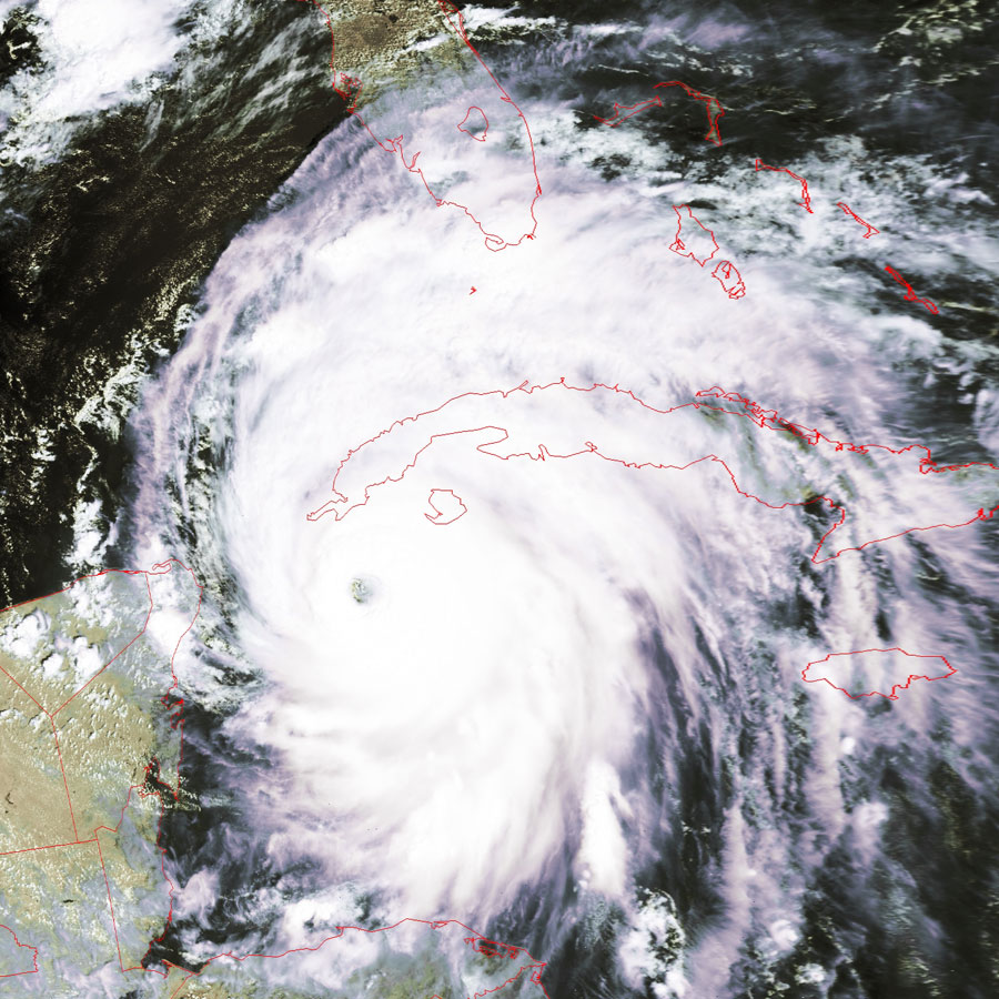
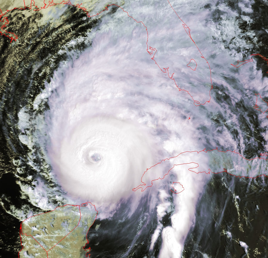
Hurricane
Ivan
Click on the images below for a higher-resolution (~200k) image of Ivan only,
showing the structure even within the eye.
In the higher-resolution image of the eye, you can even see the structure of the powerful eyewall, where the strongest of the winds
occur.
You can also see the classic spoke structure showing Ivan still drawing power
from the warmth of the ocean.
You can see Ivan's cumulative path from the
previous few
"Images of the Day".
|
Image taken yesterday afternoon,
September 13 |
Image taken this afternoon, September
14 |
 |
 |