
![]()
|
|
|
|

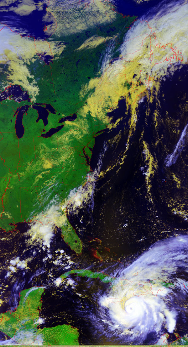
Satellite: NOAA-17,
one of NOAA's 850km-high (530 mile-high) Polar
Orbiting satellites.
Flyover beginning 11:44am EDT
Hurricane
Ivan
Hurricane Ivan is about 4 hours from
Jamaica, and is predicted to create surges up to 8 feet!
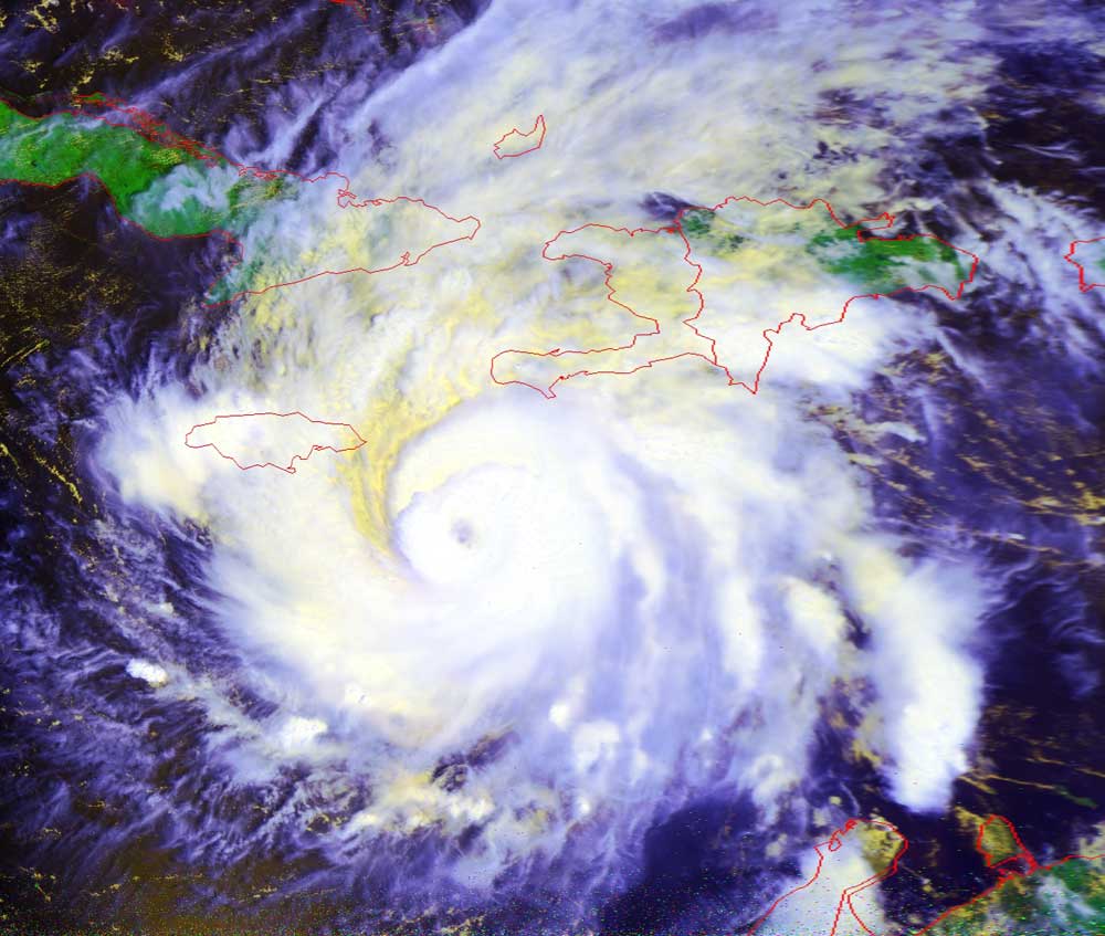
Click
here for a closeup image of Ivan clearly showing the eye of the hurricane
approaching Jamaica.
You can see from yesterday's image to today's that Ivan
is heading for the western end of Cuba.
Ultimately, Ivan will turn north and hit the US around the Florida panhandle.
If Ivan travels over this narrow end of Cuba, then he will not dissipate as much
energy as he would if he traveled over the wider part of the island.
Storm-weary Cuba and the Caribbean US can hope that Ivan does not draw too much
energy from the warm waters of the Gulf of Mexico.
Click on the image below for a higher-resolution (>200k) version.
In each of these images, you'll find the small red circle marking
the location of Radford University.