![]()
|
|
|
|

Satellite: NOAA-15 and
NOAA-17,
one of NOAA's 850km-high (530 mile-high) Polar
Orbiting satellites.
Flyover beginning 7:51am EDT
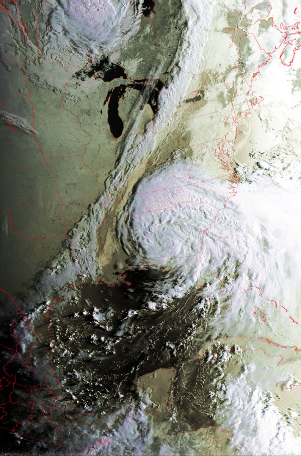
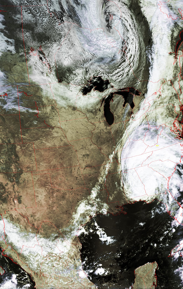
Two images of Tropical
Storm Frances
Frances moving up into the southeastern U.S.
For more information on factors that influence the paths that hurricanes take,
see Kevin Myatt's Weather Journal
on the Roanoke Times website.
You can see the evolution of the path of Frances by checking out the
previous Satellite Image of the Day pages on this
site.
Click on the images below for a higher-resolution (>100k) version.
In each of these images, you'll find the small yellow circle marking
the location of Radford University.
|
Frances is just about to meet the well-delineated cold front
coming from the west. |
Frances has just crashed into the cold front that came from the
west. |
|
|
|