
![]()
|
|
|
|

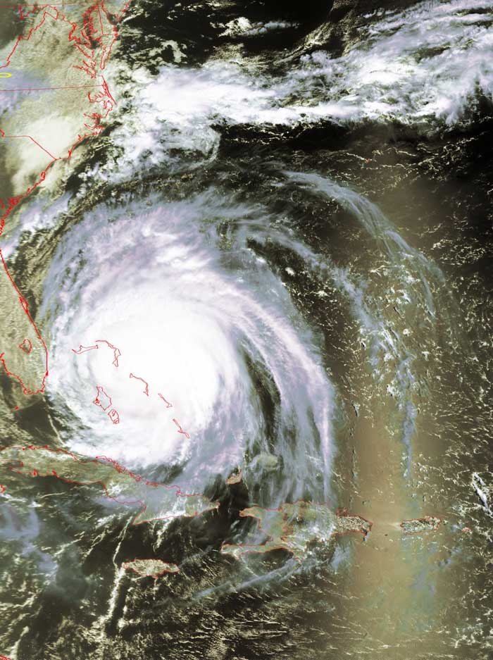
Satellite: NOAA-17,
one of NOAA's 850km-high (530 mile-high) Polar
Orbiting satellites.
Flyover beginning 11:04am EDT
Hurricane Frances
Hurricane
Frances' path
continues to take her along the (soaked) Bahama chain, towards Florida.
Frances is actually losing steam a bit, downgrading from a Category 4 to a
Category 2 hurricane.
The skewed yellow circle in the northwestern corner of this image shows the
location of Radford University.
Click on the image below for a higher-resolution (>100k) image of just the main
part of Hurricane Frances.