
![]()
|
|
|
|

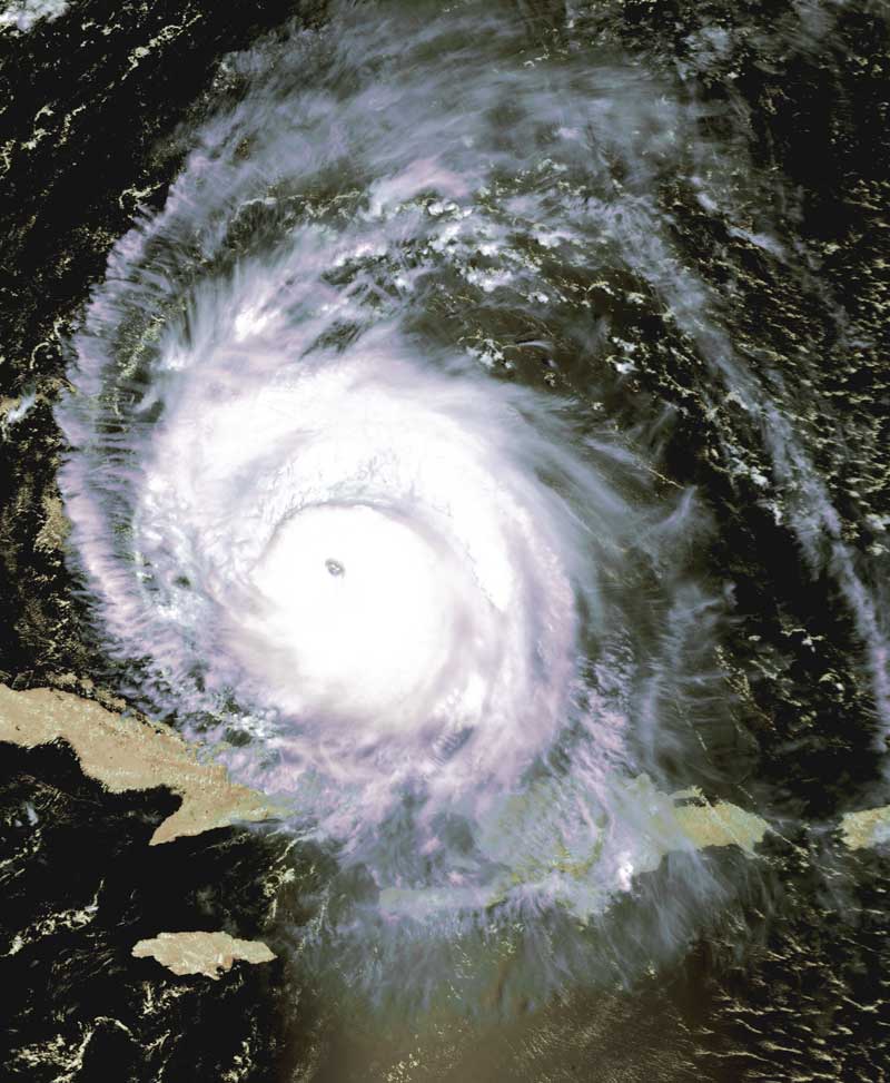
Satellite: NOAA-15,
one of NOAA's 850km-high (530 mile-high) Polar
Orbiting satellites.
Flyover beginning 11:26am EDT
Hurricane Frances
Hurricane
Frances' path
continues to take her along the (soaked) Bahama chain, towards Florida.
Frances is currently a dangerous Category 4 hurricane.
You can still see the radial "spokes" showing that Frances is still drawing heat
energy and moisture from the surrounding (warm) ocean.
Frances will soon hit the weather front that sits off of the eastern coast of
the U.S. Fraces' ultimate path will depend on how much that front can influence
Frances' motion.
Click on the image below for a higher-resolution (~95k) image of just the main
part of Hurricane Frances.