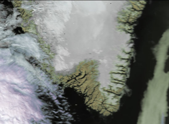
![]()
|
|
|
|

Satellite: NOAA-17,
one of NOAA's 850km-high (530 mile-high) Polar
Orbiting satellites.
Image acquired Friday, August 13, 2004; flyover beginning 3:32pm EDT
The
Greenland Ice Sheet
Average ice
thickness: approximately 2 kilometers
75% of the world's freshwater is locked up in ice sheets
such as this one on Greenland, the great ice sheet over the Antarctic, and in
glaciers.
As Earth warms due to human and other factors,
these great ice
sheets will melt and cause not only rising sea levels, but also changing
salinity of the oceans' waters.
This in turn will cause
changes in ocean circulation patterns, finally leading to
changes in weather patterns such as abrupt ice ages, etc.
Fortunately, what you see in the image below is mostly covered with ice...at the
present time.