![]()
|
|
|
|

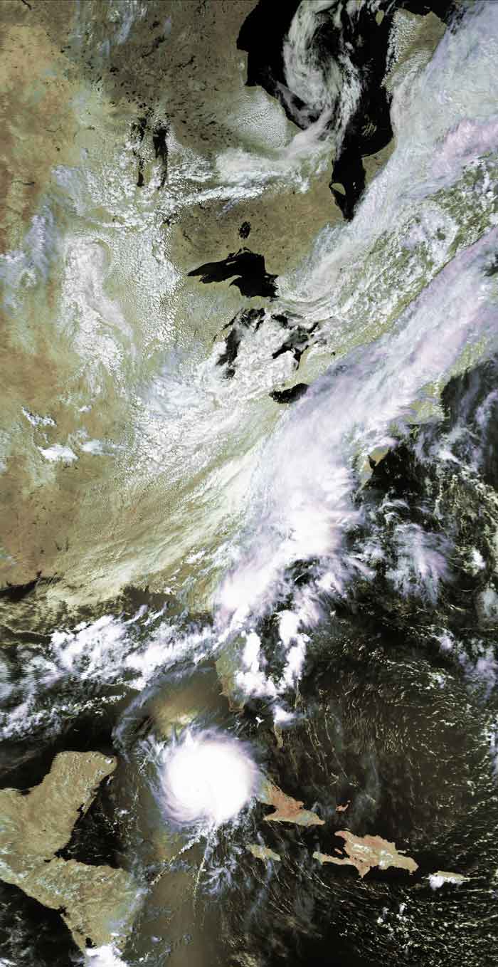
Satellite: NOAA-17,
one of NOAA's 850km-high (530 mile-high) Polar
Orbiting satellites.
August 12, 2004; flyover beginning 3:21pm EDT
Tropical Depression
Bonnie and Hurricane Charley (over Cuba)
Bonnie hit Florida right on the panhandle (ouch!), dissipated
some of her energy, and
downgraded to a tropical depression.
The image below shows how Bonnie, along with the prevailing winds over the
eastern U.S., helped the entire east coast get a good soaking.
Meanwhile, Charley continued to strengthen as it headed over the western end of
Cuba and takes aim at the already-drenched western side of Florida.
Click on the image below for a larger (100k) version.