![]()
|
|
|
|

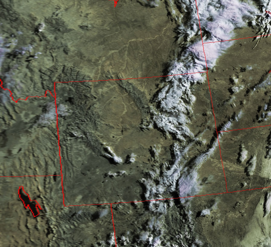
Satellite: NOAA-15,
one of NOAA's 850km-high (530 mile-high) Polar
Orbiting satellites.
Image acquired yesterday,
August 6, 2004; flyover beginning 9:17am EDT, 7:17amMDT
Yellowstone National Park
The morning shadows and a clear start to the day over our nation's first
national park located in the northwest corner of Wyoming.
Yellowstone Lake, formed by the same ancient (and not-so ancient) seismic
activity that formed the famous geysers, lies just southeast of the geographic
center of the 3,472
square mile (54 by 63 miles) park.
The Absaroka (pronounced "ab-sor'-kee") Mountain Range rises just east of Lake
Yellowstone, and is home to the
Absaroka-Beartooth Wilderness containing some of the highest, trout-filled
mountain lakes and streams in the world.
The Bighorn Mountains in north central part of Wyoming extend into Montana.
The Yellowstone (western side) and Bighorn Rivers flow between the Absorka and
Bighorn mountain ranges to combine in Montana and to eventually join the
Missouri and Mississippi Rivers.
Click on the image below for a higher-resolution image (over 100k).