Satellite Image of the Day
(click here for previous images of the day)

Satellite: NOAA-15
August 3, 2004; flyover beginning 7:09am EDT
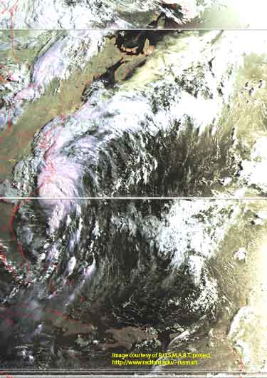
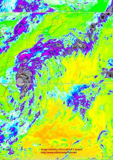
The two images below show Hurricane Alex early this morning.
The image on the left is a false color image from the vantage point of NOAA's 850km-high (530 mile-high) Polar Orbiting satellites (NOAA-15here)
The image on the right is a thermal image of the same area taken at the same time.

This picture shows Hurricane Alex as it aims for landfall at Charleston, SC.
Note how the counterclockwise rotation of Alex is pulling moisture from the Atlantic over the entire mid-Atlantic region, making for very rainy conditions.
But for those of us in southwest Virginia, note also how a high pressure region centered over Tennessee (as of this morning) is keeping the clouds/moisture to the east of us.
Click on the image below for a higher-resolution (>100k) image.

The thermal image below shows the temperature distribution of Alex.
Note how cold the upper-level clouds are: -500C.
Over the last 24 hours, Alex has pulled enough energy from the underlying ocean to drive atmospheric convection currents to become the season's first hurricane.
Click on the image below for a higher-resolution (>100k) image.