![]()
|
|
|
|
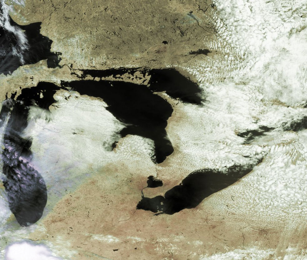
Satellite: NOAA-17
July 9, 2004; flyover beginning 2:17pm EDT
The "lake effect" is seen detail in this image.
In the image below, the east-moving air blows across the Great Lakes where it
picks up moisture. This air does not become saturated, however, and thus the
moisture in the air does not condense out to form clouds. However, once the air
slows across land, several things happen. First, to the east of most of the
Great Lakes lie some hilly, higher-elevation areas. Also, as the air moves onto
the land, it slows due to friction, and piles up on itself. Both of these
effects lead to the air being pushed upward, forcing it to cool. This
cooling lowers the ability of the air to hold moisture, and the heretofore
invisible moisture condenses out to form water droplets. When enough of these
water droplets condense out, we see the clouds on the eastern sides of the Great
Lakes.
Note also how the lake-effect-produced clouds coming off of the eastern Michigan
peninsula and moving over the southern end of Lake Huron are actually reversing
this process. Here, the air is increasing its speed and thus spreading out, and
the land elevation is decreasing. Both of these factors lead to the cloudy air
falling in elevation to the warmer areas below. The cloud droplets are
reabsorbed into the air and the moist air again becomes transparent.
When this occurs in the winter, cities such as Buffalo, NY often get tremendous
amounts of snow in a short time due to the east-moving winds pulling moisture
from the Great Lakes and dumping it on these cities.
Click on the image below for a high resolution (>200k) image.