![]()
|
|
|
|

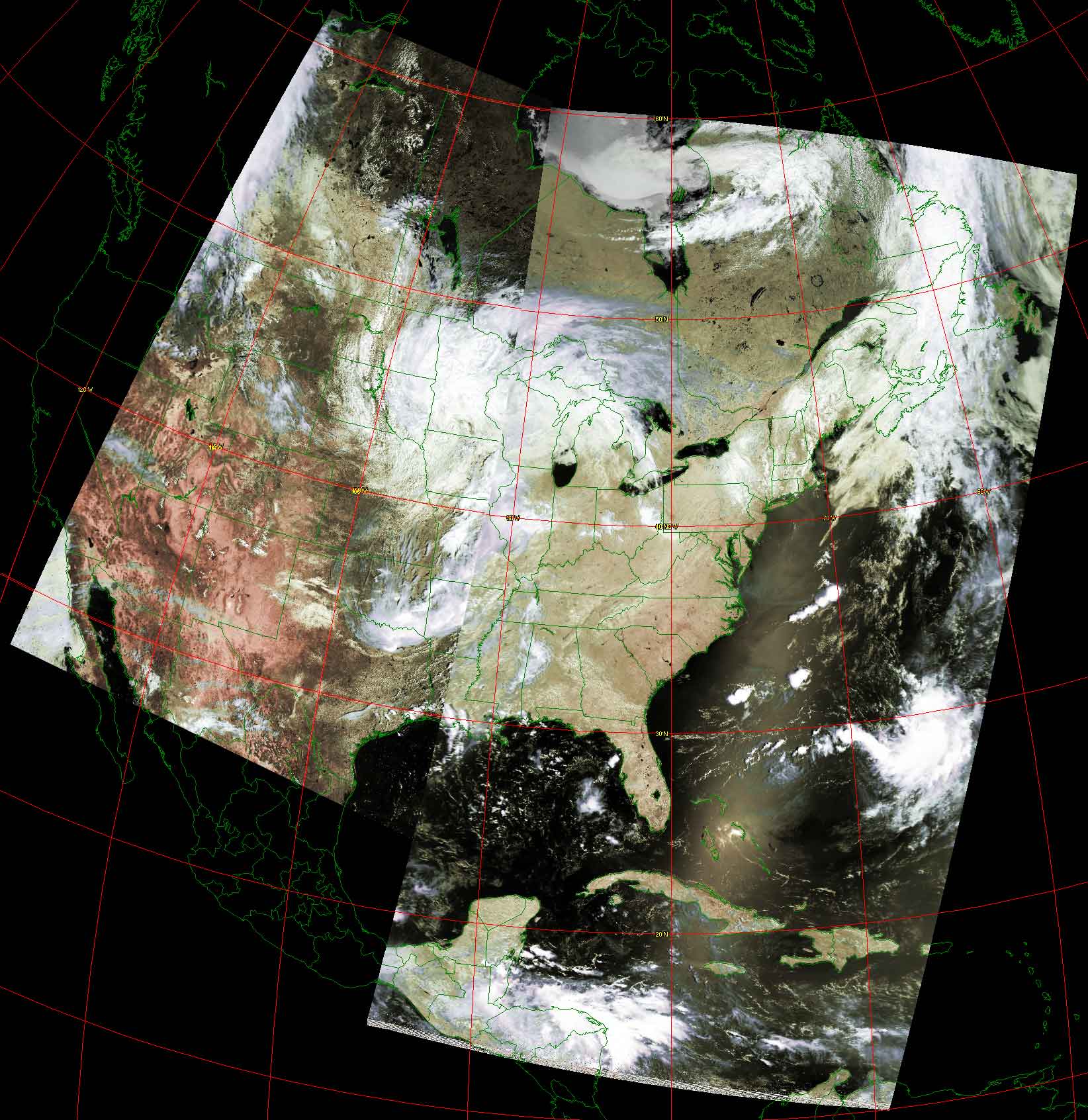
Satellite: NOAA-17
July 6, 2004; two flyover, beginning 1:46pm and 3:26pm EDT
Skies are very clear over the southeast due to 2 high pressure regions, one
centered over the Gulf states and another over Virginia (as of this image).
There is a large cloud bank over the upper midwest with the counterclockwise
circulation characteristic of mid-latitude cyclones.
The American southwest is again dry with no precipitation in sight.
Note how clearly you can see the
Manacouagan meteor
impact crater in the Quebec province of Canada; it looks like a giant smiley
face north of the St. Lawrence River in northeastern Canada!
The clouds in the Carribean southeast of the Yucatan Peninsula aren't going to
amount to much.
A cool front is moving down from the upper midwest to (hopefully) give us some
heat relief.
Click on the image below for a high resolution (>260k) image.