| Province: Blue Ridge/Valley and Ridge
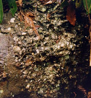
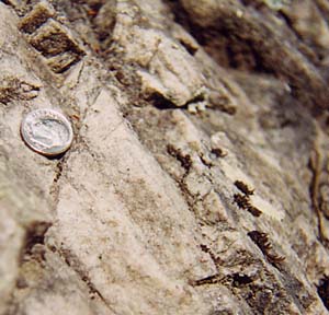
Starting in Augusta County extending southwest along the western edge of the Blue Ridge to Washington County The Unicoi Formation (400-500 meters thick) is the early Paleozoic clastic sediments that represent the transition between stream and alluvial fan sediments deposited on the rifting Laurentian crust to the first continental shelf sediments deposited on the edge of the newly formed Iapetus Ocean (Simpson and Eriksson, 1989). The lower Unicoi in the Mount Rogers area is dominantly a clast-supported quartz pebble conglomerate. Other rocks that are present are sandstone and shale. The lithology and sedimentary structures are indicative of gravel bars of rivers. The middle of the Unicoi contains two prominent basalt layers. The basalts are amygduloidal (contains holes where volcanic gas escaped that are now filled in with secondary minerals) in texture and is thought to represent lava flows associated with the rifting to form Iapetus. Further up in the sequence, the feldspathic sandstone and conglomerate of alluvial fan origin becomes interbedded with more clean quartz-rich, cross-bedded sandstone of marine origin. The marine rocks represent underwater sand dunes on a shallow, near shore continental shelf. In the rocks near where we will park our vans on the Virginia Creeper Trail on the Mount Rogers trip (stop 4), the trilobite trace fossil Rusophycus has been found (heart-shaped trilobite resting places). This is very significant because these represent some of the oldest fossils in the Appalachians and place the age of the Unicoi Formation at early Cambrian. Towards the top of the Unicoi, the rocks are all marine, and the overlying Hampton Formation carries on the trend of rising sea level (transgression), representing a muddy, outer continental shelf environment. Obviously, the Unicoi Formation contains many different rocks of differing environments, both land and sea, and records a crucial time during the early history of the Iapetus Ocean. The Unicoi Formation is the lowest member of the Chilhowee Group which includes the Hampton and Erwin Formations southwest of Augusta County. To the northeast of Augusta County, the Chilhowee Group includes, from bottom to top, the Weaverton, Harpers, and Anteitam Formations. The Weaverton is lithologically similar to the upper part of the Unicoi Formation. |
|||||||||||||||||||||||||||
|
|
||||||||||||||||||||||||||
| References:
Rankin, D.W., 1967, Guide to the Geology of the Mt. Rogers area, Virginia, North Carolina and Tennessee: Carolina Geological Society Field Trip Guidebook. Rankin, D.W., 1993, The volcanogenic Mount Rogers formation and the overlying glaciogenic Konnarock Formation - Two Late Proterozoic units in southwestern Virginia: U.S. Geological Society Bulletin 2029, 26 p. Rankin, D.W., Miller, J.M.G., Simpson, E.L., 1994, Geology of the Mt. Rogers area, southwestern Virginia Blue Ridge and Unaka Belt: in Schultz, A., and Henika, B. (editors), Fieldguides to southern Appalachian structure, stratigraphy, and engineering geology: Virginia Tech Guidebook No. 10, p. 127-176. Simpson, E.L. and Eriksson, K.A., 1989, Sedimentology of the Unicoi Formation in southern and central Virginia: Evidence for late Proterozoic to early Cambrian rift-to-passive margin transition; Geological Society of America Bulletin, v. 101, p. 42-54. Virginia Division of Mineral Resources, 1993, Geologic Map of Virginia; Department of Mines, Minerals, and Energy, Division of Mineral Resources, Charlottesville, VA. |
|||||||||||||||||||||||||||
|
|
|||||||||||||||||||||||||||
| Mount Rogers Field Trip | |||||||||||||||||||||||||||